IMAGES TAKEN NEAR TO
Isabella Drive, ORPINGTON, BR6 7UE
Introduction
This page details the photographs taken nearby to Isabella Drive, BR6 7UE by members of the Geograph project.
The Geograph project started in 2005 with the aim of publishing, organising and preserving representative images for every square kilometre of Great Britain, Ireland and the Isle of Man.

There are currently over 7.5m images from over14,400 individuals and you can help contribute to the project by visiting https://www.geograph.org.uk
Image Map
Images are licensed for reuse under creativecommons.org/licenses/by-sa/2.0
Notes
- Clicking on the map will re-center to the selected point.
- The higher the marker number, the further away the image location is from the centre of the postcode.
Image Listing (25 Images Found)
Images are licensed for reuse under creativecommons.org/licenses/by-sa/2.0
Image
Details
Distance
1
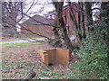
Culvert for a minor tributary of the Kyd Brook, Darrick Wood
Image: © Mike Quinn
Taken: 9 Feb 2011
0.15 miles
3
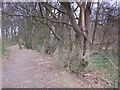
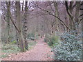
Footpath in Darrick Wood
The course of a minor tributary of the Quaggy River runs to the right of the line of trees.
Image: © Mike Quinn
Taken: 9 Feb 2011
0.17 miles
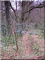
4
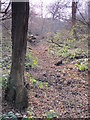
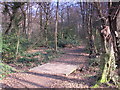
The course of a minor tributary of the Kyd Brook, Darrick Wood (2)
Image: © Mike Quinn
Taken: 9 Feb 2011
0.18 miles
5
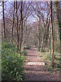
Footpath in Darrick Wood (2)
The course of a minor tributary of the Quaggy River runs to the left of the line of trees.
Image: © Mike Quinn
Taken: 9 Feb 2011
0.18 miles
6
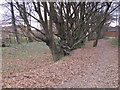
The course of a minor tributary of the Kyd Brook, Darrick Wood
Image: © Mike Quinn
Taken: 9 Feb 2011
0.20 miles
7
Footpath in Darrick Wood (3)
Image runs to the right of the line of trees.
Image: © Mike Quinn
Taken: 9 Feb 2011
0.20 miles
8
Footpath in Darrick Wood (4)
A "reverse view" is shown on Image
Image: © Mike Quinn
Taken: 9 Feb 2011
0.20 miles
9
Footbridge over a minor tributary of the Kyd Brook, Darrick Wood
Image: © Mike Quinn
Taken: 9 Feb 2011
0.20 miles
10
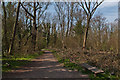
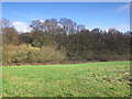
Darrick Wood
Semi-natural ancient woodland owned by Bromley Borough Council and designated a local nature reserve.
Image: © Ian Capper
Taken: 29 Mar 2012
0.20 miles