
IMAGES TAKEN NEAR TO
High Street, ORPINGTON, BR6 6BG
Introduction
This page details the photographs taken nearby to High Street, BR6 6BG by members of the Geograph project.
The Geograph project started in 2005 with the aim of publishing, organising and preserving representative images for every square kilometre of Great Britain, Ireland and the Isle of Man.

There are currently over 7.5m images from over14,400 individuals and you can help contribute to the project by visiting https://www.geograph.org.uk
Image Map
Images are licensed for reuse under creativecommons.org/licenses/by-sa/2.0
Notes
- Clicking on the map will re-center to the selected point.
- The higher the marker number, the further away the image location is from the centre of the postcode.
Image Listing (116 Images Found)
Images are licensed for reuse under creativecommons.org/licenses/by-sa/2.0
Image
Details
Distance
2
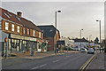
Green Street Green shops
As far as shops are concerned, Green Street Green High Street is very one sided - they line the eastern side of it for around 300 metres. This parade is in the middle of this stretch.
Image: © Ian Capper
Taken: 1 Dec 2009
0.01 miles
3
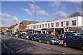
High Street
One of a number of parades of small shops in High Street.
Image: © Ian Capper
Taken: 13 Feb 2009
0.02 miles
4
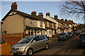
Laxey Road
Built in the early 20th century by a local builder, William Crafter, who apparently gave the road an Isle of Man name in memory of a family holiday!
Image: © Ian Capper
Taken: 4 Dec 2009
0.03 miles
5
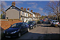
Laxey Road
Built in the early 20th century by a local builder, William Crafter, who apparently gave the road an Isle of Man name in memory of a family holiday!
Image: © Ian Capper
Taken: 13 Feb 2009
0.03 miles
6
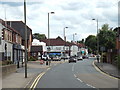
High Street, Green Street Green
The high street in Green Street Green, near Orpington.
Image: © Malc McDonald
Taken: 31 Jul 2016
0.03 miles
7
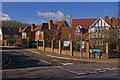
Superior Drive
Not a sign of snobbery, but part of a small development built in the 1990s with Canadian street names.
The development as a whole is known as "The Oaks", named after the Oak Brewery on whose site it was built. The brewery dominated the area for many years, having originally been founded in 1836. Fox's Ales were produced here, named after the owners of the brewery, the Fox family. However, it was forced to close in 1909, due to indebtedness, forcing over 100 people out of work, a considerable number for what was at the time a small village.
The buildings remained for a number of years, serving a variety of uses from time to time, before demolition in 1937. The site was then cleared and was developed in 1940 by the company Telegraph, Construction and Manufacture, later called Telcon, who moved here from Greenwich, manufacturing cables. Subsequently the site was occupied by Medway Packaging, before closure in 1992.
After various proposals, including a superstore, development of the site for housing was agreed, with this estate being built by Woolwich Homes.
Image: © Ian Capper
Taken: 13 Feb 2009
0.05 miles
8
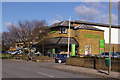
Waitrose, Green Street Green
On Sevenoaks Road, with Brittenden Parade beyond.
Image: © Ian Capper
Taken: 13 Feb 2009
0.05 miles
9
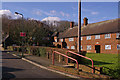
Wardens Field Close
Wardened Retirement Housing managed by Broomleigh Housing Association (see also Image).
Image: © Ian Capper
Taken: 13 Feb 2009
0.05 miles
10
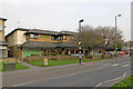
Waitrose, Green Street Green
On Sevenoaks Road. For close up of the milestone on the left, see Image
Image: © Ian Capper
Taken: 29 Mar 2011
0.05 miles