
IMAGES TAKEN NEAR TO
Pepys Rise, ORPINGTON, BR6 0WX
Introduction
This page details the photographs taken nearby to Pepys Rise, BR6 0WX by members of the Geograph project.
The Geograph project started in 2005 with the aim of publishing, organising and preserving representative images for every square kilometre of Great Britain, Ireland and the Isle of Man.

There are currently over 7.5m images from over14,400 individuals and you can help contribute to the project by visiting https://www.geograph.org.uk
Image Map
Images are licensed for reuse under creativecommons.org/licenses/by-sa/2.0
Notes
- Clicking on the map will re-center to the selected point.
- The higher the marker number, the further away the image location is from the centre of the postcode.
Image Listing (303 Images Found)
Images are licensed for reuse under creativecommons.org/licenses/by-sa/2.0
Image
Details
Distance
1
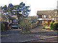
Housing diversity (Pepys Close)
A series of photos showing the diversity of housing in one gridsquare in outer suburbia. For others in series see http://www.geograph.org.uk/search.php?i=1905481. Any further information, such as building dates and what was on the sites before building, would be appreciated.
This is Pepys Close, part of a small development of mock half timbered houses, including some in Knoll Rise itself, presumably built on the site of a number of houses and back gardens on Knoll Rise.
Image: © Ian Capper
Taken: 23 Nov 2007
0.01 miles
3
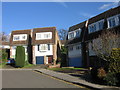
Housing diversity (The Maltings)
A series of photos showing the diversity of housing in one gridsquare in outer suburbia. For others in series see http://www.geograph.org.uk/search.php?i=1905481. Any further information, such as building dates and what was on the sites before building, would be appreciated.
These unusual detached houses are in The Maltings, built in the 1970s (?). The 1970 1 inch map shows the area as unbuilt, suggesting that the development was on former back gardens of houses in Knoll Rise and Elm Grove.
Image: © Ian Capper
Taken: 21 Nov 2007
0.04 miles
5

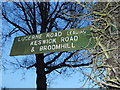
Sign to Orpington Station on Knoll Rise
Image: © David Howard
Taken: 29 Dec 2013
0.05 miles
6
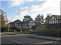
Housing diversity (Pepys Close)
A series of photos showing the diversity of housing in one gridsquare in outer suburbia. For others in series see http://www.geograph.org.uk/search.php?i=1905481. Any further information, such as building dates and what was on the sites before building, would be appreciated.
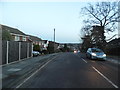
Another view of the Pepys Close development (see Image]), showing the entrance off Knoll Rise and some of the houses fronting onto that road.
Image: © Ian Capper
Taken: 23 Nov 2007
0.05 miles
8

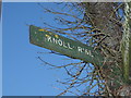
Fingerposts on Knoll Rise, Orpington
There are three of these and unlike the standard national design of the era which were pointed. The font is also not the usual pre-1964 version.
Image: © David Howard
Taken: 29 Dec 2013
0.05 miles
9
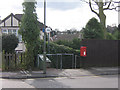
Footpath
One of a network of footpaths in the Knoll area of Orpington, the routes of which are shown on the 1868 Godfrey edition map of Orpington, which explains why they cut across the current, much more recent, road layout. This one leads from Knoll Rise towards Orpington Station - for the other end of the same path see Image
Note the green footpath sign complete with destinations - unusual in an urban situation. For close up see Image
Image: © Ian Capper
Taken: 4 Mar 2009
0.05 miles
10
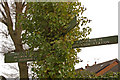
Footpath sign, Knoll Rise
A close up of the footpath sign in Image Presumably cast ones such as this were once common - now it must be a real rarity. And how many signs these days include full stops after the destination?
Only the sign on the right marks an actual footpath - the routes on the left and towards the camera are both along roads.
Image: © Ian Capper
Taken: 3 Mar 2010
0.05 miles