
IMAGES TAKEN NEAR TO
High Street, ORPINGTON, BR6 0NF
Introduction
This page details the photographs taken nearby to High Street, BR6 0NF by members of the Geograph project.
The Geograph project started in 2005 with the aim of publishing, organising and preserving representative images for every square kilometre of Great Britain, Ireland and the Isle of Man.

There are currently over 7.5m images from over14,400 individuals and you can help contribute to the project by visiting https://www.geograph.org.uk
Image Map
Images are licensed for reuse under creativecommons.org/licenses/by-sa/2.0
Notes
- Clicking on the map will re-center to the selected point.
- The higher the marker number, the further away the image location is from the centre of the postcode.
Image Listing (407 Images Found)
Images are licensed for reuse under creativecommons.org/licenses/by-sa/2.0
Image
Details
Distance
1
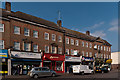
High Street
Part of Market Parade, one of a number of 1930s shopping parades in Orpington High Street, with shops below and housing above.
Image: © Ian Capper
Taken: 10 Feb 2012
0.01 miles
2
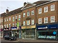
High Street
Part of Market Parade, one of a number of 1930s shopping parades in Orpington High Street, with shops below and housing above. Note the second shop from the right - whilst undergoing shopfitting for a new occupant (an Indian restaurant, replacing a previous tea shop), the signage for a long past previous occupant is temporarily being revealed, the hardware and ironmongers, Edmund Goodrich, a brand which disappeared in the c1990s. For closer view, see Image
Image: © Ian Capper
Taken: 27 Jul 2017
0.01 miles
3
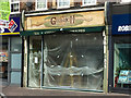
Former Edmund Goodrich ironmonger and hardware merchant
Premises in Market Parade, one of a number of 1930s shopping parades in Orpington High Street, with shops below and housing above. Whilst undergoing shopfitting for a new occupant an Indian restaurant, Masala Dabbas (replacing a previous tea shop, Mystic Brew), the signage for a long past occupant is temporarily revealed, the ironmonger and hardware merchant, Edmund Goodrich, a brand which disappeared in the c1990s. For a wider view, see Image
Image: © Ian Capper
Taken: 27 Jul 2017
0.01 miles
4
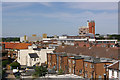
View from Memorial Car park
Looking at the back of the High Street shops, with the offices of Bancroft House beyond and the Walnuts Car Park and the tower of Orpington College beyond.
Image: © Ian Capper
Taken: 24 Jun 2009
0.02 miles
5
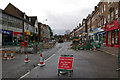
Orpington High Street improvement
Work underway the Orpington High Street Improvement scheme (see below).
Although initial work was on the pavements, late March/early April saw the southern end of the High Street closed to traffic for work on the roadway itself. Here is the road closure sign for the section south of Knoll Rise.
Image: © Ian Capper
Taken: 31 Mar 2010
0.02 miles
6
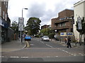
East end of Knoll Rise, Orpington
Seen from High Street.
Image: © Richard Vince
Taken: 28 Sep 2019
0.02 miles
7
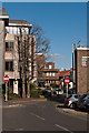
Augustus Lane
A section of Augustus Lane leading from Knoll Rise (in the background) past St Johns House (on the left).
Image: © Ian Capper
Taken: 2 Feb 2012
0.02 miles
8
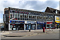
279-285 High Street
Much of the eastern side of High Street was redeveloped in the 1970s or so, and this is one of the blocks from this era.
Image: © Ian Capper
Taken: 12 Mar 2013
0.02 miles
9
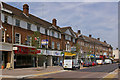
High Street
A line of shops with flats above at the southern end of Orpington High Street.
Image: © Ian Capper
Taken: 23 Jun 2010
0.02 miles
10
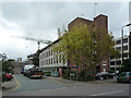
St John's House
A separate building in the Central Court complex (see Image). The cranes in the background are for the new Tesco being built on the site of a former multistorey carpark. The road in the foreground, Augustus Lane, is on the site of a former chapel shown on the 1974 OS map and also visible in a 1971 picture taken in the other direction at http://www.wsn.co.uk/orpington/history/orp71d.htm.
Image: © Ian Capper
Taken: 23 Oct 2008
0.02 miles