
IMAGES TAKEN NEAR TO
Elmcroft Road, ORPINGTON, BR6 0HY
Introduction
This page details the photographs taken nearby to Elmcroft Road, BR6 0HY by members of the Geograph project.
The Geograph project started in 2005 with the aim of publishing, organising and preserving representative images for every square kilometre of Great Britain, Ireland and the Isle of Man.

There are currently over 7.5m images from over14,400 individuals and you can help contribute to the project by visiting https://www.geograph.org.uk
Image Map
Images are licensed for reuse under creativecommons.org/licenses/by-sa/2.0
Notes
- Clicking on the map will re-center to the selected point.
- The higher the marker number, the further away the image location is from the centre of the postcode.
Image Listing (290 Images Found)
Images are licensed for reuse under creativecommons.org/licenses/by-sa/2.0
Image
Details
Distance
1
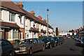
Elmcroft Road
The 1896 map shows a road here called Elmfield Road, with no houses and lined with trees. The 1909 map shows the road partially developed (and by now called Elmcroft Road). The houses seen here would seem to date from after World War I. In the background is Perry Hall Road.
Image: © Ian Capper
Taken: 3 Feb 2012
0.00 miles
3
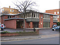
Laerdal House
UK Offices of Laerdall Medical Ltd.
What is now Laerdal Medical started in 1940 as a small publishing house specializing in greetings cards and children's books, soon expanding into the manufacture of wooden toys. They then moved into soft plastics in the early 50s, making play dolls and "furniture friendly" toy cars.
This in turn led to manikins and wound simulations for first aid and emergency medical training. This and other medical applications is now the company's focus.
Image: © Ian Capper
Taken: 5 Dec 2008
0.05 miles
4
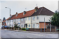
41 - 55 Perry Hall Road
Terrace of houses built in the 1910s or 1920s.
Image: © Ian Capper
Taken: 28 Mar 2013
0.05 miles
5
Perry Hall Road at the junction of Goodmead Road
Image: © David Howard
Taken: 8 Apr 2012
0.05 miles
6
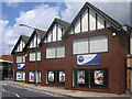
The Goodmead Centre
Now occupied by Hope Church (formerly Orpington Town Church) - an interesting use of what appears to have originally been designed as an office development.
Image: © Ian Capper
Taken: 25 Jun 2008
0.05 miles
7
Perry Hall Road, Orpington
Photo taken at the junction of Footbury Hill Road.
Image: © Danny P Robinson
Taken: 21 Jun 2007
0.05 miles
8
Chaffinch Court
Block of flats off Chislehurst Road adjacent to Redwing Court on High Street (see Image).
Image: © Ian Capper
Taken: 19 Mar 2013
0.05 miles
9
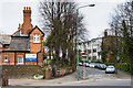
Chislehurst Road
By its junction with Goodmead Road. On the left former Chislehurst Road Junior School, now converted largely to housing (the section seen here is now an NHS clinic) and in the right background is part of Orpington telephone exchange.
Image: © Ian Capper
Taken: 28 Mar 2013
0.06 miles
10
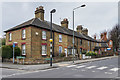
Oak Terrace, Chislehurst Road
Late Victorian terraced housing (the plaque on the corner gives a date of 1885).
Image: © Ian Capper
Taken: 28 Mar 2013
0.06 miles