IMAGES TAKEN NEAR TO
Crofton Lane, ORPINGTON, BR6 0BN
Introduction
This page details the photographs taken nearby to Crofton Lane, BR6 0BN by members of the Geograph project.
The Geograph project started in 2005 with the aim of publishing, organising and preserving representative images for every square kilometre of Great Britain, Ireland and the Isle of Man.

There are currently over 7.5m images from over14,400 individuals and you can help contribute to the project by visiting https://www.geograph.org.uk
Image Map (Loading...)


Getting Data...Please wait
Leaflet Map data © OpenStreetMap
Images are licensed for reuse under creativecommons.org/licenses/by-sa/2.0
Notes
- Clicking on the map will re-center to the selected point.
- The higher the marker number, the further away the image location is from the centre of the postcode.
Image Listing (94 Images Found)
Images are licensed for reuse under creativecommons.org/licenses/by-sa/2.0
Image
Details
Distance
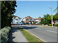
1
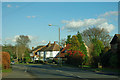
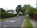
Houses on Crofton Lane
The turning for Lynwood Grove is directly ahead.
Image: © Robin Webster
Taken: 27 Jan 2012
0.01 miles
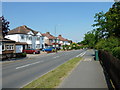
2
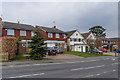
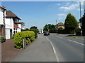
Crofton Lane
Much of Crofton Lane was developed in the interwar lanes (see Image), even though the lane itself is much older. However, according to the 1972 OS map, this short section remained as woodland. It was later developed in the late 1970s/early 1980s (?) at the same time as Buckingham Close, judging from the building style (see Image).
Image: © Ian Capper
Taken: 28 Mar 2013
0.03 miles
3
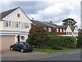
Housing diversity (Crofton Lane)
A series of photos showing the diversity of housing in one gridsquare in outer suburbia. For others in series see http://www.geograph.org.uk/search.php?i=1905481. Any further information, such as building dates and what was on the sites before building, would be appreciated.
Much of Crofton Lane was developed in the interwar lanes (see Image), even though the lane itself is much older. However, according to the 1972 OS map, this short section remained as woodland. It was later developed in the late 1970s/early 1980s (?) at the same time as Buckingham Close, judging from the building style (see Image).
Image: © Ian Capper
Taken: 2 Oct 2008
0.03 miles
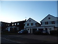
5
Lynwood Grove, Petts Wood
Like most of the roads in Petts Wood, Lynwood Grove is tree-lined. It is seen here from Crofton Lane.
Image: © Marathon
Taken: 9 Aug 2011
0.03 miles
7
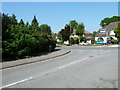
Junction of Crofton Lane and Dale Wood Road
Image: © Basher Eyre
Taken: 4 Jun 2010
0.07 miles
8
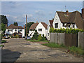
Housing diversity (Melbourne Close)
A series of photos showing the diversity of housing in one gridsquare in outer suburbia. For others in series see http://www.geograph.org.uk/search.php?i=1905481. Any further information, such as building dates and what was on the sites before building, would be appreciated.
This is Melbourne Close, a short interwar cul-de-sac off Lynwood Grove.
Image: © Ian Capper
Taken: 5 Jun 2008
0.07 miles
9
Looking from Dale Wood Road into Crofton Lane
Image: © Basher Eyre
Taken: 4 Jun 2010
0.07 miles
10
Approaching the junction of Dale Wood Road and Crofton Lane
Image: © Basher Eyre
Taken: 4 Jun 2010
0.08 miles