
IMAGES TAKEN NEAR TO
Tintagel Road, ORPINGTON, BR5 4LH
Introduction
This page details the photographs taken nearby to Tintagel Road, BR5 4LH by members of the Geograph project.
The Geograph project started in 2005 with the aim of publishing, organising and preserving representative images for every square kilometre of Great Britain, Ireland and the Isle of Man.

There are currently over 7.5m images from over14,400 individuals and you can help contribute to the project by visiting https://www.geograph.org.uk
Image Map
Images are licensed for reuse under creativecommons.org/licenses/by-sa/2.0
Notes
- Clicking on the map will re-center to the selected point.
- The higher the marker number, the further away the image location is from the centre of the postcode.
Image Listing (57 Images Found)
Images are licensed for reuse under creativecommons.org/licenses/by-sa/2.0
Image
Details
Distance
1
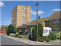
Tintagel Road
Part of the Ramsden Estate, with these houses built in 1958. Behind is the 1967 Crundale Tower (see Image).
Image: © Ian Capper
Taken: 29 Apr 2009
0.03 miles
2
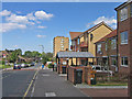
Tintagel Road
A variety of housing on the edge of the Ramsden Estate, ranging from medium density housing on the left in the distance dating from 1956, the 1967 built Crundale Tower in the background and new housing on the right dating from 2004, built as part of the refurbishment of the estate.
Image: © Ian Capper
Taken: 29 Apr 2009
0.04 miles
3
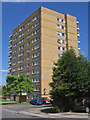
Crundale Tower
The first of three similar towers built in the late 1960s as part of the development of the Ramsden Estate, this one dating from 1967.
Image: © Ian Capper
Taken: 29 Apr 2009
0.05 miles
4
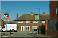
Traffic calming on Carew Way
And this is supposed to improve road safety?
Image: © Robin Webster
Taken: 3 Feb 2012
0.06 miles
5
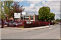
The Priory School
A specialist sports college on the Ramsden Estate.
Image: © Ian Capper
Taken: 16 May 2012
0.08 miles
6
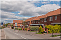
Carew Way
Recent development as part of the regeneration of the Rasmden Estate.
Image: © Ian Capper
Taken: 16 May 2012
0.09 miles
8

Ramsden's revival plaque
Close up of the plaque in Image
Image: © Ian Capper
Taken: 29 Apr 2009
0.10 miles
9
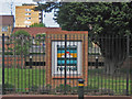
Ramsden revival plaque
This plaque in a garden in William Petty Way commemorates the refurbishment under way in the Ramsden Estate (see Image for example). It's a shame it's hidden behind railings - see Image for an unencumbered close up. In the background is the 1960s Crundale Tower.
Image: © Ian Capper
Taken: 29 Apr 2009
0.10 miles
10
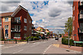
Carew Way
Recent development as part of the regeneration of the Ramsden Estate.
Image: © Ian Capper
Taken: 16 May 2012
0.10 miles