
IMAGES TAKEN NEAR TO
Sussex Road, ORPINGTON, BR5 4JF
Introduction
This page details the photographs taken nearby to Sussex Road, BR5 4JF by members of the Geograph project.
The Geograph project started in 2005 with the aim of publishing, organising and preserving representative images for every square kilometre of Great Britain, Ireland and the Isle of Man.

There are currently over 7.5m images from over14,400 individuals and you can help contribute to the project by visiting https://www.geograph.org.uk
Image Map
Images are licensed for reuse under creativecommons.org/licenses/by-sa/2.0
Notes
- Clicking on the map will re-center to the selected point.
- The higher the marker number, the further away the image location is from the centre of the postcode.
Image Listing (77 Images Found)
Images are licensed for reuse under creativecommons.org/licenses/by-sa/2.0
Image
Details
Distance
1

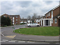
Northfield Avenue
1930s development along the route of an old footpath shown on earlier maps. Northfield itself is shown on the 1910 6" OS map as a large house to the south of this road, now all built on.
Image: © Ian Capper
Taken: 31 Mar 2009
0.04 miles
3
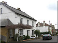
Derry Downs
A Victorian quadrangular road, the first few houses on which are shown on the 1868 Godfrey edition map. The two houses in this picture are both originals shown on that map. The one on the left is locally listed.
Image: © Ian Capper
Taken: 31 Mar 2009
0.11 miles
5

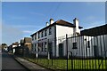
Territorial Army Centre, Anglesea Road
Built around 1908 serving for many years as a base for the 4th Battalion Royal West Kent Regiment Now the home of the 103 Cadet Company, Royal Regiment of Fusiliers.
Image: © Ian Capper
Taken: 20 Mar 2009
0.12 miles
9
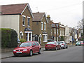
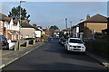
Derry Downs
A Victorian quadrangular road, the first few houses on which are shown on the 1868 Godfrey edition map.
Image: © Ian Capper
Taken: 31 Mar 2009
0.14 miles
10

Anglesea Road
Part of "Orpington New Town", originally built in the mid 19th century primarily for railway workers. The railings on the right are of the Territorial Army Centre (see Image).
Image: © Ian Capper
Taken: 18 Mar 2009
0.14 miles