IMAGES TAKEN NEAR TO
Bell Gardens, ORPINGTON, BR5 4DA
Introduction
This page details the photographs taken nearby to Bell Gardens, BR5 4DA by members of the Geograph project.
The Geograph project started in 2005 with the aim of publishing, organising and preserving representative images for every square kilometre of Great Britain, Ireland and the Isle of Man.

There are currently over 7.5m images from over14,400 individuals and you can help contribute to the project by visiting https://www.geograph.org.uk
Image Map
Images are licensed for reuse under creativecommons.org/licenses/by-sa/2.0
Notes
- Clicking on the map will re-center to the selected point.
- The higher the marker number, the further away the image location is from the centre of the postcode.
Image Listing (60 Images Found)
Images are licensed for reuse under creativecommons.org/licenses/by-sa/2.0
Image
Details
Distance
1
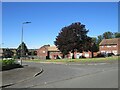
Berens Road, St Mary Cray
Berens Road is a residential road in St Mary Cray, in the outer suburbs of south east London.
Image: © Malc McDonald
Taken: 3 Oct 2021
0.08 miles
2
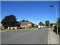
Burrfield Drive, St Mary Cray
Burrfield Drive is a residential road in St Mary Cray, in the outer suburbs of south east London.
Image: © Malc McDonald
Taken: 3 Oct 2021
0.08 miles
3
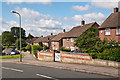
Burrfield Drive
1950s housing off Blacksmiths Lane.
Image: © Ian Capper
Taken: 19 Jul 2012
0.09 miles
4
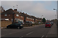
Elizabeth Way
1950s housing of High Street. Does the name suggest 1952 or 1953 as the actual building year?
Image: © Ian Capper
Taken: 16 Nov 2011
0.11 miles
6
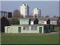
Pavilion, St Mary Cray Recreation Ground
In the background are the twin St Mary Cray tower blocks, Alkham Tower (see Image and Horton Tower (see Image).
Image: © Ian Capper
Taken: 18 Mar 2009
0.14 miles
7
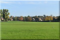
St Mary Cray Recreation Ground
On the left is the Rookery Gardens estate (see Image and on the right the twin St Mary Cray tower blocks, Alkham Tower (see Image) and Horton Tower (see Image).
Image: © Ian Capper
Taken: 18 Mar 2009
0.14 miles
8
Blacksmith's Lane at the junction of Sweeps Lane
Image: © David Howard
Taken: 8 Apr 2012
0.15 miles
9
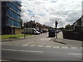
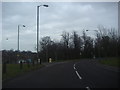
Junction of High Street and Elizabeth Way
High Street now has a 20mph speed limit, while the residential Elizabeth Way is 30mph.
Image: © Lindsey Coates
Taken: 25 Jun 2008
0.15 miles
10
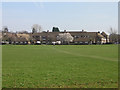
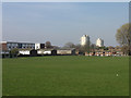
Hodsoll Court
Viewed across St Mary Cray Recreation Ground.
Image: © Ian Capper
Taken: 18 Mar 2009
0.15 miles