
IMAGES TAKEN NEAR TO
Harbledown Place, ORPINGTON, BR5 3QE
Introduction
This page details the photographs taken nearby to Harbledown Place, BR5 3QE by members of the Geograph project.
The Geograph project started in 2005 with the aim of publishing, organising and preserving representative images for every square kilometre of Great Britain, Ireland and the Isle of Man.

There are currently over 7.5m images from over14,400 individuals and you can help contribute to the project by visiting https://www.geograph.org.uk
Image Map
Images are licensed for reuse under creativecommons.org/licenses/by-sa/2.0
Notes
- Clicking on the map will re-center to the selected point.
- The higher the marker number, the further away the image location is from the centre of the postcode.
Image Listing (128 Images Found)
Images are licensed for reuse under creativecommons.org/licenses/by-sa/2.0
Image
Details
Distance
2
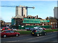
Horton Tower demolition
One of a pair of 40m high, 14 storey block of flats completed in 1968. Both it and its partner, Alkham Tower, became empty in 2007 after the buildings were declared unsafe, and after years of indecision over their future, both were demolished in 2012 with the area due to be redeveloped.
For photo of the tower before demolition, see Image
Image: © Ian Capper
Taken: 19 Jul 2012
0.03 miles
3
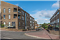
Mountfield Way
Looking along Mountfield Way from its junction with Okemore Gardens. The buildings on the left are part of The Ridge, a development completed in 2014 on the site of the 1968 Alkham and Horton Towers (see Image for photo during their demolition).
Image: © Ian Capper
Taken: 29 Jul 2015
0.03 miles
4
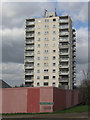
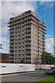
Horton Tower, St Mary Cray
One of a pair of 40m high, 14 storey block of flats completed in 1968 - see Image for its partner, Alkham Tower.
For a picture when built see http://www.ideal-homes.org.uk/bromley/assets/galleries/cray-valley/horton-tower.
Image: © Ian Capper
Taken: 27 Feb 2008
0.03 miles
5
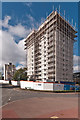
Alkham and Horton Towers demolition
A pair of 40m high, 14 storey block of flats completed in 1968, Alkham Tower being in the left background and Horton Tower in the foreground. Both became empty in 2007 after being declared unsafe, and after years of indecision over their future, they were demolished in 2012 with the area due to be redeveloped.
For photo of the towers before demolition, see Image and Image
Here Horton Tower is seen being prepared for demolition with Alkham Tower being midway through the process. A different approach is being followed for the two buildings, presumably because of Horton Tower's proximity to other buildings.
Image: © Ian Capper
Taken: 19 Jul 2012
0.03 miles
6
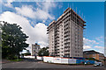
Horton Tower demolition
One of a pair of 40m high, 14 storey block of flats completed in 1968. Both it and its partner, Alkham Tower, became empty in 2007 after the buildings were declared unsafe, and after years of indecision over their future, both were demolished in 2012 with the area due to be redeveloped.
For photo of the tower before demolition, see Image
Here Horton Tower is seen being prepared for demolition. A different process was followed compared with Alkham Tower (see in the left background), presumably because of proximity to other buildings (such as Portland House, to its immediate right here).
Image: © Ian Capper
Taken: 19 Jul 2012
0.03 miles
7
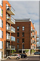
The Ridge
Part of The Ridge, a development completed in 2014 on the site of the 1968 Alkham and Horton Towers (see Image for photo during their demolition). On the left is Apex House and beyond is Pinnacle House.
Image: © Ian Capper
Taken: 29 Jul 2015
0.03 miles
8
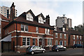
The Old Police Station
The Old Police Station on High Street in St Mary Cray, dating from 1896. It ceased to have its original role in around 1980, when its functions transferred to Orpington, and after a variety of uses it has now been converted to flats, going under the name Warwick House. It is locally listed.
The building on the right of the photo, Durley House, dates from the 18th century and is grade II listed - see www.historicengland.org.uk/listing/the-list/list-entry/1359328.
In the background are Horton and Alkham Towers, dating from 1968. In 2012, after this photo was taken, both towers were demolished - see Image
Image: © Ian Capper
Taken: 16 Nov 2011
0.03 miles
9
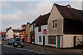
High Street
Buildings on High Street. The nearest, Nos 87 - 91, is grade II listed with two separate listings: No 87 (the furthest section) dates from the 18th/19th century while nos 89 - 91 (the nearer two sections of the same building) has 16th century origins. For listing particulars see www.historicengland.org.uk/listing/the-list/list-entry/1186844 and www.historicengland.org.uk/listing/the-list/list-entry/1298993 respectively.
Image: © Ian Capper
Taken: 16 Nov 2011
0.03 miles
10
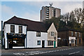
87 - 97 High Street
A range of buildings on High Street. No 87 (on the left) dates from the 18th/19th century while nos 89 - 91 (the right hand side of the same building) has 16th century origins. Both are grade II listed - see www.historicengland.org.uk/listing/the-list/list-entry/1186844 and www.historicengland.org.uk/listing/the-list/list-entry/1298993 respectively. Nos 95 - 97, on the right, was built in 1840 and is locally listed. In the background is the 1968 built Alkham Tower, which was demolished in 2012, after this photo was taken - see Image
Image: © Ian Capper
Taken: 16 Nov 2011
0.03 miles