IMAGES TAKEN NEAR TO
Lullingstone Close, ORPINGTON, BR5 3ED
Introduction
This page details the photographs taken nearby to Lullingstone Close, BR5 3ED by members of the Geograph project.
The Geograph project started in 2005 with the aim of publishing, organising and preserving representative images for every square kilometre of Great Britain, Ireland and the Isle of Man.

There are currently over 7.5m images from over14,400 individuals and you can help contribute to the project by visiting https://www.geograph.org.uk
Image Map
Images are licensed for reuse under creativecommons.org/licenses/by-sa/2.0
Notes
- Clicking on the map will re-center to the selected point.
- The higher the marker number, the further away the image location is from the centre of the postcode.
Image Listing (20 Images Found)
Images are licensed for reuse under creativecommons.org/licenses/by-sa/2.0
Image
Details
Distance
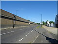
1
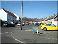
Lullingstone Crescent, St Paul's Cray
Image: © Stacey Harris
Taken: 15 Mar 2009
0.04 miles
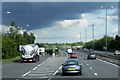
6
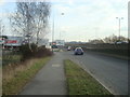
A20 Slip Road at Crittall's Corner Sidcup
Image: © Stacey Harris
Taken: 16 Feb 2009
0.15 miles
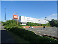
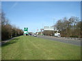
9
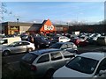
Busy Saturday afternoon at B&Q store, Footscray
Image: © David Martin
Taken: 21 Jan 2012
0.18 miles
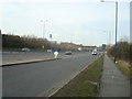
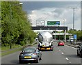
10
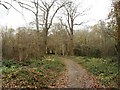
Scadbury Park Nature Reserve, Chislehurst
Scadbury Park was acquired by the London Borough of Bromley in 1983 and became a nature reserve in 1985. Though surrounded by suburbia, its extensive woods and grazing land give it a very rural character.
Image: © David Kemp
Taken: 20 Nov 2008
0.20 miles