IMAGES TAKEN NEAR TO
Mickleham Road, ORPINGTON, BR5 2RW
Introduction
This page details the photographs taken nearby to Mickleham Road, BR5 2RW by members of the Geograph project.
The Geograph project started in 2005 with the aim of publishing, organising and preserving representative images for every square kilometre of Great Britain, Ireland and the Isle of Man.

There are currently over 7.5m images from over14,400 individuals and you can help contribute to the project by visiting https://www.geograph.org.uk
Image Map
Images are licensed for reuse under creativecommons.org/licenses/by-sa/2.0
Notes
- Clicking on the map will re-center to the selected point.
- The higher the marker number, the further away the image location is from the centre of the postcode.
Image Listing (38 Images Found)
Images are licensed for reuse under creativecommons.org/licenses/by-sa/2.0
Image
Details
Distance
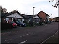
1
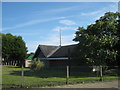
Giggs Hill Church (2)
United Reformed Church on Giggs Hill Road.
Image: © David Anstiss
Taken: 24 Jul 2011
0.05 miles
2
Giggs Hill Church
United Reformed Church on Giggs Hill Road.
Image: © David Anstiss
Taken: 24 Jul 2011
0.05 miles
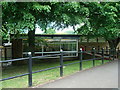
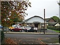
3
Sanderson Hall, St Pauls Cray
Sports club on Mickleham Road.
Image: © David Anstiss
Taken: 24 Jul 2011
0.07 miles
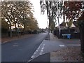
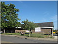
8
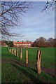
Towards Chorleywood Crescent
Looking across Image
Image: © Glyn Baker
Taken: 18 Jan 2019
0.11 miles
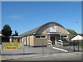
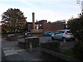
9
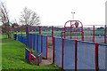
Hoblingwell Wood Rec
The basketball court on the Rec in St Paul's Cray see https://www.bromley.gov.uk/directory_record/1212715/hoblingwell_wood_recreation_ground
Image: © Glyn Baker
Taken: 18 Jan 2019
0.13 miles