
IMAGES TAKEN NEAR TO
Barcombe Close, ORPINGTON, BR5 2QD
Introduction
This page details the photographs taken nearby to Barcombe Close, BR5 2QD by members of the Geograph project.
The Geograph project started in 2005 with the aim of publishing, organising and preserving representative images for every square kilometre of Great Britain, Ireland and the Isle of Man.

There are currently over 7.5m images from over14,400 individuals and you can help contribute to the project by visiting https://www.geograph.org.uk
Image Map
Images are licensed for reuse under creativecommons.org/licenses/by-sa/2.0
Notes
- Clicking on the map will re-center to the selected point.
- The higher the marker number, the further away the image location is from the centre of the postcode.
Image Listing (28 Images Found)
Images are licensed for reuse under creativecommons.org/licenses/by-sa/2.0
Image
Details
Distance
2
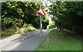
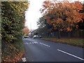
Leesons Hill - Steep Hill 14%
Leesons Hill, St Paul's Cray. 14% steep hill down sign.
Image: © Adam Morse
Taken: 5 Aug 2009
0.14 miles
4
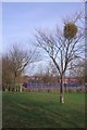
Mistletoe and Hoblingwell Rec
Looking towards the basketball Court on Image
Image: © Glyn Baker
Taken: 18 Jan 2019
0.15 miles
6
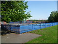
Playground at Hoblingwell Wood Recreation Ground, St Paul's Cray
Hoblingwell Wood is an open space of two halves. The eastern part here is a fairly flat and formal recreation ground whilst the western half is hilly and largely wooded.
Image: © Marathon
Taken: 27 Jun 2011
0.16 miles
8
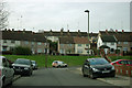
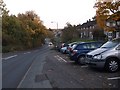
Silverdale Road - awkward TV reception
Although not very far from the very powerful transmitters in the Crystal Palace area, the very high aerials show the road is in the shadow of high ground. Even the higher Ringshall Road beyond has a bit of a problem.
Image: © Robin Webster
Taken: 14 Feb 2012
0.17 miles
9
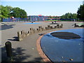
Playground at Hoblingwell Wood Recreation Ground, St Paul's Cray
Hoblingwell Wood is an open space of two halves. The eastern part here is a fairly flat and formal recreation ground whilst the western half is hilly and largely wooded.
Image: © Marathon
Taken: 27 Jun 2011
0.17 miles
10
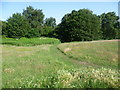
Looking towards Hoblingwell Wood, St Paul's Cray
Hoblingwell Wood is an open space of two halves. The eastern part is a fairly flat and formal recreation ground whilst the western half is hilly and largely wooded. This is near the junction of the two and is looking towards the edge of the woodland.
Image: © Marathon
Taken: 27 Jun 2011
0.17 miles