
IMAGES TAKEN NEAR TO
Ascot Road, ORPINGTON, BR5 2JE
Introduction
This page details the photographs taken nearby to Ascot Road, BR5 2JE by members of the Geograph project.
The Geograph project started in 2005 with the aim of publishing, organising and preserving representative images for every square kilometre of Great Britain, Ireland and the Isle of Man.

There are currently over 7.5m images from over14,400 individuals and you can help contribute to the project by visiting https://www.geograph.org.uk
Image Map
Images are licensed for reuse under creativecommons.org/licenses/by-sa/2.0
Notes
- Clicking on the map will re-center to the selected point.
- The higher the marker number, the further away the image location is from the centre of the postcode.
Image Listing (62 Images Found)
Images are licensed for reuse under creativecommons.org/licenses/by-sa/2.0
Image
Details
Distance
1
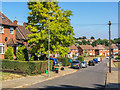
Ascot Road
Late 1940s housing on former woodland.
Image: © Ian Capper
Taken: 14 Sep 2016
0.06 miles
2
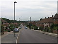
Amherst Drive, Poverest
In the distance can be seen the St Mary Cray tower blocks.
Image: © Ian Capper
Taken: 29 May 2008
0.07 miles
3
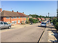
Amherst Drive
Late 1940s housing running south of the railway west of St Mary Cray Station. The 1950 6" map (presumably based on an earlier revision date, given that aerial photos show these houses under construction in 1949) shows an initial outline of this section of the road, but with the name Sefton Road, a name that now applies only to the continuation close to its junction with Sherborne Road, houses on which date from the 1930s.
Image: © Ian Capper
Taken: 14 Sep 2016
0.08 miles
4
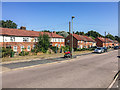
Amherst Drive
Late 1940s housing running south of the railway west of St Mary Cray Station. The 1950 6" map (presumably based on an earlier revision date, given that aerial photos show these houses under construction in 1949) shows an initial outline of this section of the road, but with the name Sefton Road, a name that now applies only to the continuation close to its junction with Sherborne Road, houses on which date from the 1930s.
Image: © Ian Capper
Taken: 14 Sep 2016
0.08 miles
5
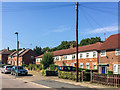
Amherst Drive
Late 1940s housing running south of the railway west of St Mary Cray Station. The 1950 6" map (presumably based on an earlier revision date, given that aerial photos show these houses under construction in 1949) shows an initial outline of this section of the road, but with the name Sefton Road, a name that now applies only to the continuation close to its junction with Sherborne Road, houses on which date from the 1930s.
Image: © Ian Capper
Taken: 14 Sep 2016
0.08 miles
6
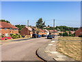
Amherst Drive
Late 1940s housing running south of the railway west of St Mary Cray Station. The 1950 6" map (presumably based on an earlier revision date, given that aerial photos show these houses under construction in 1949) shows an initial outline of this section of the road, but with the name Sefton Road, a name that now applies only to the continuation close to its junction with Sherborne Road, houses on which date from the 1930s.
Image: © Ian Capper
Taken: 14 Sep 2016
0.09 miles
8
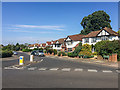
Sefton Road
Late 1930s housing on the eastern edge of Petts Wood, seen here at its junction with Sherborne Road.
Image: © Ian Capper
Taken: 14 Sep 2016
0.12 miles
9
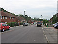
Amherst Drive, Poverest
Near its junction with Dorney Rise.
Image: © Ian Capper
Taken: 29 May 2008
0.12 miles
10
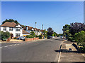
Sherborne Road
Late 1930s housing on the eastern edge of Petts Wood.
Image: © Ian Capper
Taken: 14 Sep 2016
0.12 miles