
IMAGES TAKEN NEAR TO
Littlejohn Road, ORPINGTON, BR5 2BX
Introduction
This page details the photographs taken nearby to Littlejohn Road, BR5 2BX by members of the Geograph project.
The Geograph project started in 2005 with the aim of publishing, organising and preserving representative images for every square kilometre of Great Britain, Ireland and the Isle of Man.

There are currently over 7.5m images from over14,400 individuals and you can help contribute to the project by visiting https://www.geograph.org.uk
Image Map
Images are licensed for reuse under creativecommons.org/licenses/by-sa/2.0
Notes
- Clicking on the map will re-center to the selected point.
- The higher the marker number, the further away the image location is from the centre of the postcode.
Image Listing (79 Images Found)
Images are licensed for reuse under creativecommons.org/licenses/by-sa/2.0
Image
Details
Distance
1

Littlejohn Road
Part of an area south of Poverest Road developed before or after the Second World War, although exact timing is unclear: the 1944 Kent XVI NE 6" map based on 1938 revisions shows much of the area with housing shown in outline, whereas the 1946 London Sheet T also based on 1938 revisions still shows open countryside.
Most of the road names in the area have connections with Robin Hood, inspired by the name of an area of woodland called Robin Hood Shaw which was on part of the site.
Image: © Ian Capper
Taken: 17 Aug 2016
0.03 miles
2
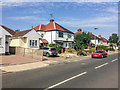
Austin Road
Part of an area south of Poverest Road developed before or after the Second World War, although exact timing is unclear: the 1944 Kent XVI NE 6" map based on 1938 revisions shows much of the area with housing shown in outline, whereas the 1946 London Sheet T also based on 1938 revisions still shows open countryside.
Most of the road names in the area have connections with Robin Hood, inspired by the name of an area of woodland called Robin Hood Shaw which was on part of the site. However, this road would seem to be an exception.
Image: © Ian Capper
Taken: 14 Sep 2016
0.05 miles
3
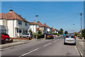
Austin Road
Part of an area south of Poverest Road developed before or after the Second World War, although exact timing is unclear: the 1944 Kent XVI NE 6" map based on 1938 revisions shows much of the area with housing shown in outline, whereas the 1946 London Sheet T also based on 1938 revisions still shows open countryside.
Most of the road names in the area have connections with Robin Hood, inspired by the name of an area of woodland called Robin Hood Shaw which was on part of the site. However, this road would seem to be an exception.
Image: © Ian Capper
Taken: 17 Aug 2016
0.05 miles
4
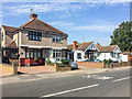
Austin Road
Part of an area south of Poverest Road developed before or after the Second World War, although exact timing is unclear: the 1944 Kent XVI NE 6" map based on 1938 revisions shows much of the area with housing shown in outline, whereas the 1946 London Sheet T also based on 1938 revisions still shows open countryside.
Most of the road names in the area have connections with Robin Hood, inspired by the name of an area of woodland called Robin Hood Shaw which was on part of the site. However, this road would seem to be an exception.
Image: © Ian Capper
Taken: 14 Sep 2016
0.06 miles
5
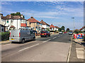
Austin Road
Part of an area south of Poverest Road developed before or after the Second World War, although exact timing is unclear: the 1944 Kent XVI NE 6" map based on 1938 revisions shows much of the area with housing shown in outline, whereas the 1946 London Sheet T also based on 1938 revisions still shows open countryside.
Most of the road names in the area have connections with Robin Hood, inspired by the name of an area of woodland called Robin Hood Shaw which was on part of the site. However, this road would seem to be an exception.
Image: © Ian Capper
Taken: 14 Sep 2016
0.06 miles
6
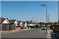
Oakdene Road
Part of an area south of Poverest Road developed before or after the Second World War, although exact timing is unclear: the 1944 Kent XVI NE 6" map based on 1938 revisions shows much of the area with housing shown in outline, whereas the 1946 London Sheet T also based on 1938 revisions still shows open countryside.
Most of the road names in the area have obvious connections with Robin Hood, inspired by the name of an area of woodland called Robin Hood Shaw which was on part of the site. However, this road would seem to be an exception.
Image: © Ian Capper
Taken: 17 Aug 2016
0.07 miles
7
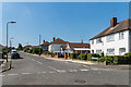
Oakdene Road
Part of an area south of Poverest Road developed before or after the Second World War, although exact timing is unclear: the 1944 Kent XVI NE 6" map based on 1938 revisions shows much of the area with housing shown in outline, whereas the 1946 London Sheet T also based on 1938 revisions still shows open countryside.
Most of the road names in the area have obvious connections with Robin Hood, inspired by the name of an area of woodland called Robin Hood Shaw which was on part of the site. However, this road would seem to be an exception.
Image: © Ian Capper
Taken: 17 Aug 2016
0.07 miles
8
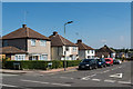
Friar Road
Part of an area south of Poverest Road developed before or after the Second World War, although exact timing is unclear: the 1944 Kent XVI NE 6" map based on 1938 revisions shows much of the area with housing shown in outline, whereas the 1946 London Sheet T also based on 1938 revisions still shows open countryside.
Most of the road names in the area have connections with Robin Hood, inspired by the name of an area of woodland called Robin Hood Shaw which was on part of the site.
Image: © Ian Capper
Taken: 17 Aug 2016
0.08 miles
9
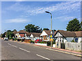
Friar Road
Part of an area south of Poverest Road developed before or after the Second World War, although exact timing is unclear: the 1944 Kent XVI NE 6" map based on 1938 revisions shows much of the area with housing shown in outline, whereas the 1946 London Sheet T also based on 1938 revisions still shows open countryside.
Most of the road names in the area have connections with Robin Hood, inspired by the name of an area of woodland called Robin Hood Shaw which was on part of the site.
Image: © Ian Capper
Taken: 14 Sep 2016
0.10 miles
10
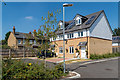
Bellefield Road
New housing in Bellefield Road. In contrast, in the background is late Victorian terraced housing in Cross Road.
Image: © Ian Capper
Taken: 17 Aug 2016
0.10 miles