
IMAGES TAKEN NEAR TO
Friar Road, ORPINGTON, BR5 2BW
Introduction
This page details the photographs taken nearby to Friar Road, BR5 2BW by members of the Geograph project.
The Geograph project started in 2005 with the aim of publishing, organising and preserving representative images for every square kilometre of Great Britain, Ireland and the Isle of Man.

There are currently over 7.5m images from over14,400 individuals and you can help contribute to the project by visiting https://www.geograph.org.uk
Image Map
Images are licensed for reuse under creativecommons.org/licenses/by-sa/2.0
Notes
- Clicking on the map will re-center to the selected point.
- The higher the marker number, the further away the image location is from the centre of the postcode.
Image Listing (57 Images Found)
Images are licensed for reuse under creativecommons.org/licenses/by-sa/2.0
Image
Details
Distance
1
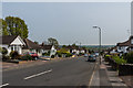
Friar Road
Part of an area south of Poverest Road developed before or after the Second World War, although exact timing is unclear: the 1944 Kent XVI NE 6" map based on 1938 revisions shows much of the area with housing shown in outline, whereas the 1946 London Sheet T also based on 1938 revisions still shows open countryside.
Most of the road names in the area have connections with Robin Hood, inspired by the name of an area of woodland called Robin Hood Shaw which was on part of the site.
Image: © Ian Capper
Taken: 24 Apr 2015
0.03 miles
2
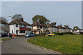
Robin Hood Green
Part of an area south of Poverest Road developed before or after the Second World War, although exact timing is unclear: the 1944 Kent XVI NE 6" map based on 1938 revisions shows much of the area with housing shown in outline, whereas the 1946 London Sheet T also based on 1938 revisions still shows open countryside. However, as far as Robin Hood Green is concerned, even the Kent maps only show houses in outline on the section to the east of this area of open land, suggesting that this western arm is postwar.
Most of the road names in the area have connections with Robin Hood, inspired by the name of an area of woodland called Robin Hood Shaw which was on part of the site.
Image: © Ian Capper
Taken: 24 Apr 2015
0.05 miles
3
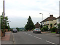
Friar Road
On a part of Poverest Estate with road names with a Robin Hood theme.
Image: © Ian Capper
Taken: 29 May 2008
0.06 miles
4
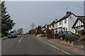
Friar Road
Part of an area south of Poverest Road developed before or after the Second World War, although exact timing is unclear: the 1944 Kent XVI NE 6" map based on 1938 revisions shows much of the area with housing shown in outline, whereas the 1946 London Sheet T also based on 1938 revisions still shows open countryside.
Most of the road names in the area have connections with Robin Hood, inspired by the name of an area of woodland called Robin Hood Shaw which was on part of the site.
Image: © Ian Capper
Taken: 24 Apr 2015
0.07 miles
5
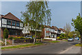
Archer Road
Part of an area south of Poverest Road developed before or after the Second World War, although exact timing is unclear: the 1944 Kent XVI NE 6" map based on 1938 revisions shows much of the area with housing shown in outline, whereas the 1946 London Sheet T also based on 1938 revisions still shows open countryside.
Most of the road names in the area have connections with Robin Hood, inspired by the name of an area of woodland called Robin Hood Shaw which was on part of the site.
Image: © Ian Capper
Taken: 24 Apr 2015
0.08 miles
6
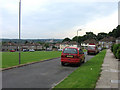
Robin Hood Green
On a part of Poverest Estate with road names with a Robin Hood theme.
Image: © Ian Capper
Taken: 29 May 2008
0.08 miles
7
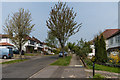
Archer Road
Part of an area south of Poverest Road developed before or after the Second World War, although exact timing is unclear: the 1944 Kent XVI NE 6" map based on 1938 revisions shows much of the area with housing shown in outline, whereas the 1946 London Sheet T also based on 1938 revisions still shows open countryside.
Most of the road names in the area have connections with Robin Hood, inspired by the name of an area of woodland called Robin Hood Shaw which was on part of the site.
Image: © Ian Capper
Taken: 24 Apr 2015
0.08 miles
8
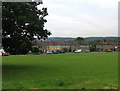
Robin Hood Green
On a part of Poverest Estate with road names with a Robin Hood theme.
Image: © Ian Capper
Taken: 29 May 2008
0.08 miles
9
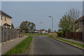
Sward Road
Short road connecting Oakdene Road with Robin Hood Green in the background. It is part of an area south of Poverest Road developed before or after the Second World War, although exact timing is unclear: the 1944 Kent XVI NE 6" map based on 1938 revisions shows much of the area with housing shown in outline, whereas the 1946 London Sheet T also based on 1938 revisions still shows open countryside.
Most of the road names in the area have connections with Robin Hood, inspired by the name of an area of woodland called Robin Hood Shaw which was on part of the site.
Image: © Ian Capper
Taken: 24 Apr 2015
0.09 miles
10
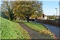
Top of Cray Valley Road
The road descends from this point into the Cray Valley south of St Mary Cray station.
Image: © David Martin
Taken: 28 Nov 2022
0.10 miles