
IMAGES TAKEN NEAR TO
Brockwell Close, ORPINGTON, BR5 1RJ
Introduction
This page details the photographs taken nearby to Brockwell Close, BR5 1RJ by members of the Geograph project.
The Geograph project started in 2005 with the aim of publishing, organising and preserving representative images for every square kilometre of Great Britain, Ireland and the Isle of Man.

There are currently over 7.5m images from over14,400 individuals and you can help contribute to the project by visiting https://www.geograph.org.uk
Image Map
Images are licensed for reuse under creativecommons.org/licenses/by-sa/2.0
Notes
- Clicking on the map will re-center to the selected point.
- The higher the marker number, the further away the image location is from the centre of the postcode.
Image Listing (64 Images Found)
Images are licensed for reuse under creativecommons.org/licenses/by-sa/2.0
Image
Details
Distance
2
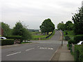
Sherborne Road, Poverest
Running down to its junction with Church Hill Wood, with Tillingbourne Green the other side of the junction, leading to the Poverest Centre and Poverest Primary School.
Image: © Ian Capper
Taken: 29 May 2008
0.06 miles
3
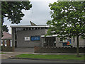
Christ Lutheran Church, Poverest Road
A member of the Evangelical Lutheran Church of England.
Image: © Ian Capper
Taken: 30 May 2008
0.06 miles
5
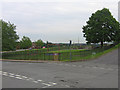
Tillingbourne Green Recreation Ground, Poverest
At the junction between Tillingbourne Green (to the right) and Church Hill Wood (running left to right).
Image: © Ian Capper
Taken: 29 May 2008
0.07 miles
6
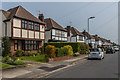
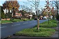
Kedleston Drive
1930s housing on the Robin Hood Estate, so called because most of the road names in the area have connections with Robin Hood, inspired by the name of an area of woodland called Robin Hood Shaw which was on part of the site. However the connection here (the origin presumably being Kedleston Hall in Derbyshire) is less obvious,
These houses are in a short northern section of Kedleston Drive which was laid out in the 1930s, being shown on the 1945 6 inch map (based on a 1938 revision) marked as Kedelstone Drive. The 1950 map again only shows the same section, by now with its current spelling. The rest of the road was built in the 1950s, built on part of Covet Wood.
Image: © Ian Capper
Taken: 24 Apr 2015
0.09 miles
8
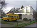
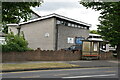
Poverest Road Baptist Church
Founded in the 1930s as an offshoot of Orpington Baptist Church, the present building dates from 1963.
Image: © Ian Capper
Taken: 5 Dec 2008
0.10 miles
9
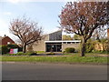
Poverest Road Baptist Church, Orpington
Image: © David Howard
Taken: 12 Apr 2015
0.10 miles
10
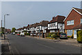
Kedleston Drive
Mainly 1930s housing on the Robin Hood Estate, so called because most of the road names in the area have connections with Robin Hood, inspired by the name of an area of woodland called Robin Hood Shaw which was on part of the site. However the connection here (the origin presumably being Kedleston Hall in Derbyshire) is less obvious,
These houses are in a short northern section of Kedleston Drive which was laid out in the 1930s, being shown on the 1945 6 inch map (based on a 1938 revision) marked as Kedelstone Drive. The 1950 map again only shows the same section, by now with its current spelling. The rest of the road was built in the 1950s, built on part of Covet Wood.
Image: © Ian Capper
Taken: 24 Apr 2015
0.10 miles