IMAGES TAKEN NEAR TO
Kingsway, ORPINGTON, BR5 1PU
Introduction
This page details the photographs taken nearby to Kingsway, BR5 1PU by members of the Geograph project.
The Geograph project started in 2005 with the aim of publishing, organising and preserving representative images for every square kilometre of Great Britain, Ireland and the Isle of Man.

There are currently over 7.5m images from over14,400 individuals and you can help contribute to the project by visiting https://www.geograph.org.uk
Image Map
Images are licensed for reuse under creativecommons.org/licenses/by-sa/2.0
Notes
- Clicking on the map will re-center to the selected point.
- The higher the marker number, the further away the image location is from the centre of the postcode.
Image Listing (104 Images Found)
Images are licensed for reuse under creativecommons.org/licenses/by-sa/2.0
Image
Details
Distance
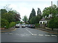
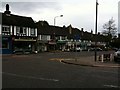
3
Petts Wood Road
Petts Wood is a very tidy, well looked after sort of place.
Image: © Des Blenkinsopp
Taken: 12 May 2015
0.10 miles
4
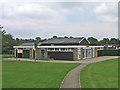
Willett Recreation Ground - pavilion
See Image for background to recreation ground. The pavilion was opened in 1987, replacing a previous one badly damaged by fire in 1985.
Image: © Ian Capper
Taken: 30 May 2008
0.11 miles
6
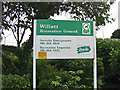
Willett Recreation Ground
Willett Recreation Ground sits in a triangle of land between Towncourt Crescent, Crossway and Kingsway. It was reserved for recreation in the original plan for Petts Wood in the late 1920s. It is the home of Petts Wood Cricket Club and also includes tennis courts, a bowling green and a children's play area. Like a number of sites in Petts Wood, its name commemorates William Willett, who lived in nearby Chislehurst and who campaigned for the introduction of daylight saving (the precursor of British Summer Time).
Image: © Ian Capper
Taken: 30 May 2008
0.11 miles
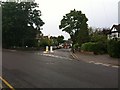
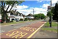
9
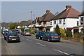
Crossway
Part of the 1930s development of Petts Wood. In the background is Hazlemere Road.
Image: © Ian Capper
Taken: 25 Mar 2011
0.12 miles
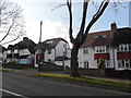
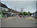
10
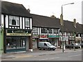
Mock Tudorbethan shops and flats, Petts Wood Road, BR5
Image: © Mike Quinn
Taken: 13 Oct 2010
0.13 miles