
IMAGES TAKEN NEAR TO
Ash Close, ORPINGTON, BR5 1LQ
Introduction
This page details the photographs taken nearby to Ash Close, BR5 1LQ by members of the Geograph project.
The Geograph project started in 2005 with the aim of publishing, organising and preserving representative images for every square kilometre of Great Britain, Ireland and the Isle of Man.

There are currently over 7.5m images from over14,400 individuals and you can help contribute to the project by visiting https://www.geograph.org.uk
Image Map
Images are licensed for reuse under creativecommons.org/licenses/by-sa/2.0
Notes
- Clicking on the map will re-center to the selected point.
- The higher the marker number, the further away the image location is from the centre of the postcode.
Image Listing (139 Images Found)
Images are licensed for reuse under creativecommons.org/licenses/by-sa/2.0
Image
Details
Distance
2
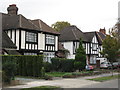
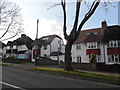
Faux mock Tudorbethan houses, West Way, Petts Wood, BR5
Shows the location of Image
Image: © Mike Quinn
Taken: 14 Oct 2010
0.09 miles
3
George VI postbox, Fairway / Westway, Petts Wood, BR5
The box has the remains of a "post office direction" sign holder. The location of this postbox is shown in Image
Image: © Mike Quinn
Taken: 14 Oct 2010
0.09 miles
5
Daylight Inn
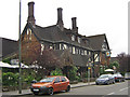
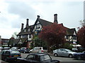
Opened in December 1935, and built in a mock Tudor style to fit in with the surroundings of Station Square, to a design of Sydney Clarke. It included a large ballroom/banqueting hall with stage, and served as a venue for public meetings/amateur dramatics/dinners. In its early years it was also a hotel with 13 bedrooms. The name refers to the campaign by William Willett, who lived in nearby Chislehurst, and whose campaigning at the start of the 20th century had led to the eventual introduction of summer time. It was while horse riding in Petts Wood (the wood itself, pre development) that the idea of daylight saving came to him. Other than this pub, he is commemorated in various ways in Petts Wood, with a road and a recreation ground named after him, as well as a memorial in Petts Wood (see Image).
Image: © Ian Capper
Taken: 30 May 2008
0.12 miles
8
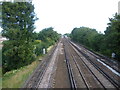
Looking up the line towards Petts Wood station
The line was opened in 1868, when the South Eastern Railway opened its cut-off line between Chislehurst and Tonbridge. Previously, trains between London and Tunbridge Wells had taken a circuitous route via Redhill. This view looks up the line in the direction of Petts Wood station from the footbridge which links Towncourt Lane with Beaumont Road. Petts Wood station was not opened until 1928, and the community now surrounding it developed from that date.
Image: © Marathon
Taken: 9 Aug 2011
0.13 miles
10
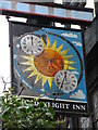
Sign for The Daylight Inn, Station Square, Petts Wood, BR5
See Image and Image The BBC Domesday Reloaded site http://www.bbc.co.uk/history/domesday/dblock/GB-544000-165000/page/9 says that “The inn sign explains daylight saving. There is a picture of the sun and at either side there is a clock. One of the clocks says twelve o'clock and the other says one o'clock. There are two arrows near the edge to show that in spring the clocks are put forward and in autumn the clocks are put back.” But it looks to me as though both clocks say 12 o'clock. So do those on Image
Image: © Mike Quinn
Taken: 13 Oct 2010
0.13 miles