IMAGES TAKEN NEAR TO
Beaumont Road, ORPINGTON, BR5 1JG
Introduction
This page details the photographs taken nearby to Beaumont Road, BR5 1JG by members of the Geograph project.
The Geograph project started in 2005 with the aim of publishing, organising and preserving representative images for every square kilometre of Great Britain, Ireland and the Isle of Man.

There are currently over 7.5m images from over14,400 individuals and you can help contribute to the project by visiting https://www.geograph.org.uk
Image Map
Images are licensed for reuse under creativecommons.org/licenses/by-sa/2.0
Notes
- Clicking on the map will re-center to the selected point.
- The higher the marker number, the further away the image location is from the centre of the postcode.
Image Listing (90 Images Found)
Images are licensed for reuse under creativecommons.org/licenses/by-sa/2.0
Image
Details
Distance
1
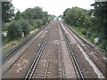
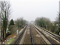
Petts Wood: South Eastern Main Line (1)
Although this railway now forms the South Eastern Main Line, this particular section was a latecomer, only being constructed by the South Eastern Railway and opening in 1868. Petts Wood station, whose platforms are visible in the distance, was even later, only being built in 1928. This is the view from the footbridge on the path connecting Beaumont Road and Towncourt Lane. The footbridge predates the surrounding housing development by many years and was already in place by the time that the Ordnance Survey's map of 1909 was published.
Image: © Nigel Cox
Taken: 22 Sep 2013
0.03 miles
2
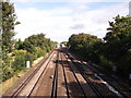
Railway to Petts Wood
As seen from Image
This line leads from Sevenoaks (via Orpington) towards Petts Wood and onwards (via Bromley South) towards central London.
In the background is Petts Wood Railway Station
Image: © David Anstiss
Taken: 28 Aug 2011
0.04 miles
3
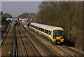
South of Petts Wood Station
Southeastern Networker no 465009 on the 12.55 London Victoria to Orpington service, having just left its penultimate stop, Petts Wood (seen in the background). The station was built in 1928, to serve the planned development of Petts Wood.
Image: © Ian Capper
Taken: 5 Mar 2010
0.05 miles
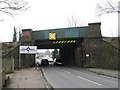
5
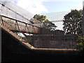
Footbridge over railway near Towncourt Lane
This bridge leads between Towncourt Lane and Beaumont Road.
Image: © David Anstiss
Taken: 28 Aug 2011
0.06 miles
6
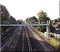
Railway to Orpington
As seen from Image
This line leads from central London (via Bromley South and Petts Wood) towards
Sevenoaks (via Orpington).
A signal bridge is also seen.
Image: © David Anstiss
Taken: 28 Aug 2011
0.07 miles
7
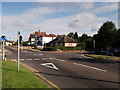
Roundabout on Queensway
Towncourt Lane leads from Orpington onto Queensway.
Tudor Way leads right to St. Mary Cray, Petts Wood.
Ryecroft Way leads left to Shepperton Road.
Image: © David Anstiss
Taken: 28 Aug 2011
0.07 miles
9
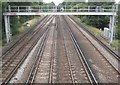
Petts Wood: South Eastern Main Line (2)
Although this railway now forms the South Eastern Main Line, this particular section was a latecomer, only being constructed by the South Eastern Railway and opening in 1868. Petts Wood station was even later, only being built in 1928. This is the view from the footbridge on the path connecting Beaumont Road and Towncourt Lane. The footbridge predates the surrounding housing development by many years and was already in place by the time that the Ordnance Survey's map of 1909 was published.
Image: © Nigel Cox
Taken: 22 Sep 2013
0.08 miles