
IMAGES TAKEN NEAR TO
Romany Rise, ORPINGTON, BR5 1HG
Introduction
This page details the photographs taken nearby to Romany Rise, BR5 1HG by members of the Geograph project.
The Geograph project started in 2005 with the aim of publishing, organising and preserving representative images for every square kilometre of Great Britain, Ireland and the Isle of Man.

There are currently over 7.5m images from over14,400 individuals and you can help contribute to the project by visiting https://www.geograph.org.uk
Image Map
Images are licensed for reuse under creativecommons.org/licenses/by-sa/2.0
Notes
- Clicking on the map will re-center to the selected point.
- The higher the marker number, the further away the image location is from the centre of the postcode.
Image Listing (110 Images Found)
Images are licensed for reuse under creativecommons.org/licenses/by-sa/2.0
Image
Details
Distance
1
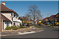
Romany Rise
A development of semi detached and detached houses off St Thomas' Drive (in the background). Maps suggest that this section dates from immediately before or after the Second World War.
Image: © Ian Capper
Taken: 28 Mar 2012
0.04 miles
2

St Thomas' Drive
A development of semi detached and detached houses off Crofton Lane. Maps suggest that this section dates from immediately before or after the Second World War, although the section in the background (see Image for closer view) was later.
Image: © Ian Capper
Taken: 28 Mar 2012
0.08 miles
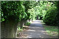
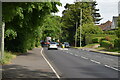
5
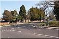
Crofton Road/Crofton Avenue junction
The junction of Crofton Avenue with Crofton Road. To add further to the mix the footpath opposite leads through to Crofton Lane, which itself meets Crofton Road at the roundabout near the right hand edge of the photo (see Image).
Image: © Ian Capper
Taken: 29 Mar 2012
0.11 miles
7

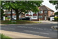
St Thomas' Drive
A development of bungalows off Crofton Lane, backing onto Roundabout Wood (in the background). Maps suggest that this section dates from the 1950s.
Image: © Ian Capper
Taken: 28 Mar 2012
0.12 miles
8
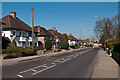
Crofton Lane
A mix of semi detached and detached houses dating from immediately before or after the Second World War, along what was once a country lane (see Image for the only older building from before this development).
Image: © Ian Capper
Taken: 28 Mar 2012
0.13 miles
9
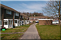
Clareville Road
1980s development off Crofton Road - earlier maps show a more typical development of semi-detached houses with long gardens along Crofton Road itself.
Image: © Ian Capper
Taken: 29 Mar 2012
0.13 miles
10
The Kyd Brook - East Branch, on Gumping Common (5)
Image: © Mike Quinn
Taken: 18 Nov 2010
0.13 miles