IMAGES TAKEN NEAR TO
Sherborne Road, ORPINGTON, BR5 1GW
Introduction
This page details the photographs taken nearby to Sherborne Road, BR5 1GW by members of the Geograph project.
The Geograph project started in 2005 with the aim of publishing, organising and preserving representative images for every square kilometre of Great Britain, Ireland and the Isle of Man.

There are currently over 7.5m images from over14,400 individuals and you can help contribute to the project by visiting https://www.geograph.org.uk
Image Map
Images are licensed for reuse under creativecommons.org/licenses/by-sa/2.0
Notes
- Clicking on the map will re-center to the selected point.
- The higher the marker number, the further away the image location is from the centre of the postcode.
Image Listing (52 Images Found)
Images are licensed for reuse under creativecommons.org/licenses/by-sa/2.0
Image
Details
Distance
1
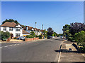
Sherborne Road
Late 1930s housing on the eastern edge of Petts Wood.
Image: © Ian Capper
Taken: 14 Sep 2016
0.02 miles
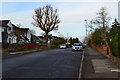
3
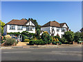
Sefton Road
Late 1930s housing on the eastern edge of Petts Wood.
Image: © Ian Capper
Taken: 14 Sep 2016
0.03 miles
4
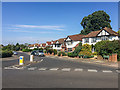
Sefton Road
Late 1930s housing on the eastern edge of Petts Wood, seen here at its junction with Sherborne Road.
Image: © Ian Capper
Taken: 14 Sep 2016
0.05 miles
5

Sefton Road, Petts Wood
On the eastern edge of Petts Wood - approach it from the east, such as from Amherst Drive (see Image), and the contrast in style is obvious.
Image: © Ian Capper
Taken: 29 May 2008
0.07 miles
6
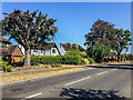
Poverest Road
The western section of Poverest Road, with a postal address of Petts Wood. It was developed in the late 1940s.
Image: © Ian Capper
Taken: 14 Sep 2016
0.07 miles
7
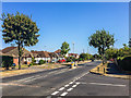
Poverest Road
The western section of Poverest Road, with a postal address of Petts Wood. This section of the road was developed in the late 1940s, although the bungalows seen here, opposite the start of Sutherland Avenue, may have been slightly later (early 1950s?).
Image: © Ian Capper
Taken: 14 Sep 2016
0.08 miles
8
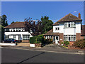
Sherborne Road
1950s(?) housing on the eastern edge of Petts Wood.
Image: © Ian Capper
Taken: 14 Sep 2016
0.09 miles
9
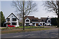
Chislehurst Road
1930s mock Tudor houses built by the master builder Noel Rees, characteristic of his work in Petts Wood.
Image: © Ian Capper
Taken: 25 Mar 2011
0.09 miles