IMAGES TAKEN NEAR TO
Goodhart Way, WEST WICKHAM, BR4 0HA
Introduction
This page details the photographs taken nearby to Goodhart Way, BR4 0HA by members of the Geograph project.
The Geograph project started in 2005 with the aim of publishing, organising and preserving representative images for every square kilometre of Great Britain, Ireland and the Isle of Man.

There are currently over 7.5m images from over14,400 individuals and you can help contribute to the project by visiting https://www.geograph.org.uk
Image Map
Images are licensed for reuse under creativecommons.org/licenses/by-sa/2.0
Notes
- Clicking on the map will re-center to the selected point.
- The higher the marker number, the further away the image location is from the centre of the postcode.
Image Listing (29 Images Found)
Images are licensed for reuse under creativecommons.org/licenses/by-sa/2.0
Image
Details
Distance

3
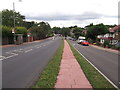
Following the pink path on Pickhurst Lane
Past Brambledown Close, this lane has a small close of houses on a parallel road to the lane.
Both are called Pickhurst Lane!
Image: © David Anstiss
Taken: 28 Aug 2011
0.06 miles
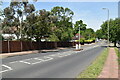
7
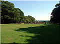
Recreation ground by Cupola Wood BR2
Bounded by Mead Way to the north and pickhurst Lane to the west. The wood is to the left of the children's play area.
Image: © Philip Talmage
Taken: 31 Aug 2005
0.11 miles