IMAGES TAKEN NEAR TO
Dorset Road, BECKENHAM, BR3 4ED
Introduction
This page details the photographs taken nearby to Dorset Road, BR3 4ED by members of the Geograph project.
The Geograph project started in 2005 with the aim of publishing, organising and preserving representative images for every square kilometre of Great Britain, Ireland and the Isle of Man.

There are currently over 7.5m images from over14,400 individuals and you can help contribute to the project by visiting https://www.geograph.org.uk
Image Map
Images are licensed for reuse under creativecommons.org/licenses/by-sa/2.0
Notes
- Clicking on the map will re-center to the selected point.
- The higher the marker number, the further away the image location is from the centre of the postcode.
Image Listing (142 Images Found)
Images are licensed for reuse under creativecommons.org/licenses/by-sa/2.0
Image
Details
Distance
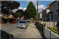
2
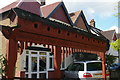
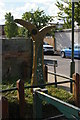
Traditional Hungarian gateway, Dorset Road, Elmers End
Gateways such as this are a Hungarian folk-art form. Their inscriptions vary; this, I believe, says something to the effect that the owner prefers to be hospitable to visitors but that a bad reception awaits people of evil intent.
Image: © Christopher Hilton
Taken: 30 Jul 2015
0.03 miles
4
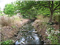
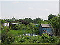
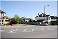
The Chaffinch Brook - Elmers End Branch, north of Dorset Road, BR3
Image: © Mike Quinn
Taken: 25 May 2010
0.06 miles
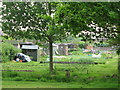
6
The course of the Chaffinch Brook - Elmers End Branch, northeast of Elmers End Road, BR3
I think that the stream runs underneath this concrete driveway - see Image and Image and the satellite image http://wtp2.appspot.com/wheresthepath.htm?lat=51.40126884564762&lon=-0.052300172708267645&gz=19&oz=11>=1.
Image: © Mike Quinn
Taken: 25 May 2010
0.07 miles
7
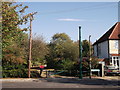
National Cycle Route marker at the entrance to Elmers End Recreation Ground
Elmers End Recreation Ground is accessed from Maberley Road and is tucked unobtrusively between a stream and the railway. The Waterlink Way, part of National Cycle Route 21 (http://www.sustrans.org.uk/ncn/map/route/waterlink-way?&_suid=137595140798605604763373926261 ), passes through it.
Image: © Christopher Hilton
Taken: 30 Jul 2015
0.07 miles
8
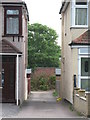
Footpath to Elmer's End Playing Fields
As seen from Ancaster Road.
This track is also used by National Cycle Network Route 21 leading to Beck Lane.
Image: © David Anstiss
Taken: 16 Oct 2011
0.08 miles
10
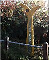
National Cycle Network Route 21 Milepost, Elmer's End
Beside Image, leading towards Beck Lane.
Image: © David Anstiss
Taken: 16 Oct 2011
0.09 miles