IMAGES TAKEN NEAR TO
Shirley Crescent, BECKENHAM, BR3 4AZ
Introduction
This page details the photographs taken nearby to Shirley Crescent, BR3 4AZ by members of the Geograph project.
The Geograph project started in 2005 with the aim of publishing, organising and preserving representative images for every square kilometre of Great Britain, Ireland and the Isle of Man.

There are currently over 7.5m images from over14,400 individuals and you can help contribute to the project by visiting https://www.geograph.org.uk
Image Map
Images are licensed for reuse under creativecommons.org/licenses/by-sa/2.0
Notes
- Clicking on the map will re-center to the selected point.
- The higher the marker number, the further away the image location is from the centre of the postcode.
Image Listing (74 Images Found)
Images are licensed for reuse under creativecommons.org/licenses/by-sa/2.0
Image
Details
Distance
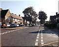
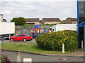
1
Semi-circle on Goddard Road
Goddard Road leads from Elmer's End road towards Croydon Road.
Another section of the road heads left around this small open-space area.
Image: © David Anstiss
Taken: 16 Oct 2011
0.04 miles
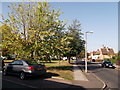
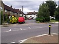
2
Road junction on Goddard Road
Goddard Road leads from Croydon Road towards Elmer's End Road.
Shirley Crescent leads right, in a curve back towards Goddard Road.
Langley Road leads left towards Croydon Road.
Image: © David Anstiss
Taken: 16 Oct 2011
0.06 miles
3
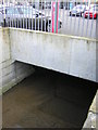
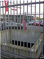
Chaffinch Brook emerges briefly from culvert
The Chaffinch Brook passes under the Chaffinch Business Park in a culvert, but briefly sees the light here in the middle of the tarmac apron in front of some industrial units.
For another view, see Image; for context, see Image
Image: © Christopher Hilton
Taken: 27 Mar 2011
0.08 miles
4
Chaffinch Brook emerges briefly from culvert
The Chaffinch Brook passes under the Chaffinch Business Park in a culvert, but briefly sees the light here in the middle of the tarmac apron in front of some industrial units.
For another view, see Image; for context, see Image
Image: © Christopher Hilton
Taken: 27 Mar 2011
0.08 miles
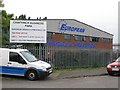
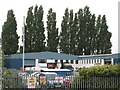
5
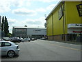
Chaffinch Industrial Estate
Despite the picturesque name, a typical assemblage of "big shed" architecture.
In the middle distance, behind the silver car parked sideways-on to the camera, is the railed enclosure where the Chaffinch Brook emerges from culvert into the light for ten feet or so: see Image and Image
Image: © Christopher Hilton
Taken: 19 May 2011
0.09 miles
6
Elmers End: industrial estate and housing beyond
The housing is up a slight slope that marks the far side of the valley of the Chaffinch Brook, partially culverted along here.
Image: © Christopher Hilton
Taken: 16 Jun 2011
0.10 miles
7
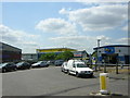
Big shed architecture at Elmers End: type one, the basic
Big sheds on the Chaffinch Industrial Estate, whose entrance is here. Off the other side of the roundabout, the other type of big shed, the toytown supermarket: Image
Image: © Christopher Hilton
Taken: 19 May 2011
0.11 miles
9
Chaffinch Business Park, Elmers End (2)
See also Image
Image: © Mike Quinn
Taken: 26 May 2010
0.12 miles