IMAGES TAKEN NEAR TO
Wickham Way, BECKENHAM, BR3 3AR
Introduction
This page details the photographs taken nearby to Wickham Way, BR3 3AR by members of the Geograph project.
The Geograph project started in 2005 with the aim of publishing, organising and preserving representative images for every square kilometre of Great Britain, Ireland and the Isle of Man.

There are currently over 7.5m images from over14,400 individuals and you can help contribute to the project by visiting https://www.geograph.org.uk
Image Map
Images are licensed for reuse under creativecommons.org/licenses/by-sa/2.0
Notes
- Clicking on the map will re-center to the selected point.
- The higher the marker number, the further away the image location is from the centre of the postcode.
Image Listing (26 Images Found)
Images are licensed for reuse under creativecommons.org/licenses/by-sa/2.0
Image
Details
Distance
1
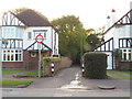
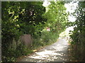
St. Dunstan's Lane, Park Langley, near Beckenham
St. Dunstan's Lane is a narrow private lane passing between houses in the outer suburbs of south east London.
The sign prohibits vehicles more than 7 feet wide from attempting to enter the lane.
Image: © Malc McDonald
Taken: 27 Oct 2019
0.05 miles
2
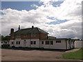
The Warren Annexe
On St Dunstan's Lane.
The clubhouse of the Junior Football Club.
Image: © David Anstiss
Taken: 28 Aug 2011
0.06 miles
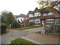
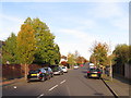
4
Wickham Way at the junction of Brabourne Road
Image: © David Howard
Taken: 18 Oct 2015
0.06 miles
5
St. Dunstan's Lane, BR3
The darker section of fencing with vertical slats on the left of the lane marks the point at which the lane crosses the east branch of The Beck.
Image: © Mike Quinn
Taken: 2 Aug 2010
0.07 miles
6
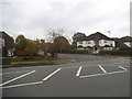
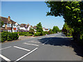
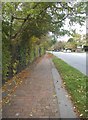
Brabourne Rise, Park Langley, near Beckenham
Brabourne Rise is a residential road in Park Langley, in the outer suburbs of south east London.
This view was taken on a late October afternoon. The sun was low in the sky, casting long shadows, while leaves were changing colour and falling from the trees.
Image: © Malc McDonald
Taken: 27 Oct 2019
0.08 miles
7
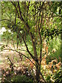
(The line of) the east branch of The Beck
There was a small amount of water in the stream bed; see also Image
Image: © Mike Quinn
Taken: 2 Aug 2010
0.08 miles
8
Beckenham: Wickham Way
From the end of Bushey Way. A house on the left has been decorated with flags and bunting for the Queen's Diamond Jubilee, due in a few days.
Image: © Dr Neil Clifton
Taken: 25 May 2012
0.09 miles
10
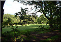
Langley Park Golf Club
Inaugurated on 28th May 1910, the course was built on parkland. Set in 120 acres and measuring some 6300 yds with a par of 68 off the yellow markers, Langley is a qualifying course for the Open Championship. The photograph was taken from Lodge Road, looking east.
Image: © Philip Talmage
Taken: 7 Aug 2005
0.12 miles