
IMAGES TAKEN NEAR TO
Highland Croft, BECKENHAM, BR3 1TB
Introduction
This page details the photographs taken nearby to Highland Croft, BR3 1TB by members of the Geograph project.
The Geograph project started in 2005 with the aim of publishing, organising and preserving representative images for every square kilometre of Great Britain, Ireland and the Isle of Man.

There are currently over 7.5m images from over14,400 individuals and you can help contribute to the project by visiting https://www.geograph.org.uk
Image Map
Images are licensed for reuse under creativecommons.org/licenses/by-sa/2.0
Notes
- Clicking on the map will re-center to the selected point.
- The higher the marker number, the further away the image location is from the centre of the postcode.
Image Listing (98 Images Found)
Images are licensed for reuse under creativecommons.org/licenses/by-sa/2.0
Image
Details
Distance
2
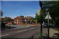
View north along Beckenham Road towards Lewisham
As the sign on the right indicates, this is on the Green Chain Walk / Capital Ring combined long distance footpath: at this point the path leaves the road to head into Beckenham Place Park.
Image: © Christopher Hilton
Taken: 8 May 2016
0.04 miles
3
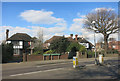
House on Two Roads
Southend Road (Bromley) becomes Beckenham Hill Road (Lewisham) where the two London Boroughs meet.
Image: © Des Blenkinsopp
Taken: 24 Feb 2016
0.06 miles
5
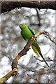
Ring Necked Parakeet
Ring necked parakeets https://www.rspb.org.uk/our-work/our-positions-and-casework/our-positions/species/invasive-non-native-species/ring-necked-parakeets/ Might not be the most common bird in Image https://www.lewisham.gov.uk/inmyarea/openspaces/parks/beckenham-place-park/Pages/default.aspx but they are the most visible and vocal residents!
Image: © Glyn Baker
Taken: 1 Feb 2018
0.07 miles
7
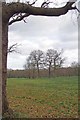
Beckenham Place Park
The park is managed by Lewisham Council https://www.lewisham.gov.uk/inmyarea/openspaces/parks/beckenham-place-park/Pages/default.aspx
Image: © Glyn Baker
Taken: 1 Feb 2018
0.09 miles
9
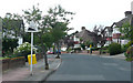
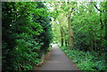
Braeside - Steep Hill 17%
Braeside, Beckenham. 17% steep hill down sign.
Image: © Adam Morse
Taken: 9 Aug 2009
0.11 miles
10
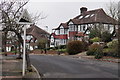
Braeside, Beckenham
A quiet residential road ... with a steep hill which is not marked on the map.
Image: © Peter Trimming
Taken: 16 Dec 2016
0.12 miles