IMAGES TAKEN NEAR TO
Copers Cope Road, BECKENHAM, BR3 1NR
Introduction
This page details the photographs taken nearby to Copers Cope Road, BR3 1NR by members of the Geograph project.
The Geograph project started in 2005 with the aim of publishing, organising and preserving representative images for every square kilometre of Great Britain, Ireland and the Isle of Man.

There are currently over 7.5m images from over14,400 individuals and you can help contribute to the project by visiting https://www.geograph.org.uk
Image Map
Images are licensed for reuse under creativecommons.org/licenses/by-sa/2.0
Notes
- Clicking on the map will re-center to the selected point.
- The higher the marker number, the further away the image location is from the centre of the postcode.
Image Listing (109 Images Found)
Images are licensed for reuse under creativecommons.org/licenses/by-sa/2.0
Image
Details
Distance
1
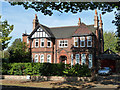
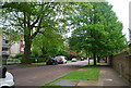
House on Brackley Road, Beckenham
One of the original late 19th century houses on this road, many of which have been substituted by modern blocks of flats.
Image: © Robin Webster
Taken: 1 Oct 2011
0.03 miles
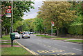
2
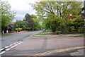
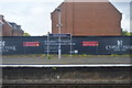
Junction of Brackley Rd and Copers Cope Rd
Image: © N Chadwick
Taken: 9 May 2010
0.04 miles
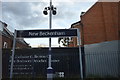
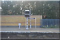
4
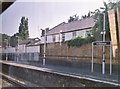
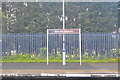
New Beckenham Railway Station, from the train
Seen is the down, southbound, platform.
Image: © Christopher Hilton
Taken: 29 May 2012
0.04 miles