IMAGES TAKEN NEAR TO
Kings Hall Road, BECKENHAM, BR3 1LJ
Introduction
This page details the photographs taken nearby to Kings Hall Road, BR3 1LJ by members of the Geograph project.
The Geograph project started in 2005 with the aim of publishing, organising and preserving representative images for every square kilometre of Great Britain, Ireland and the Isle of Man.

There are currently over 7.5m images from over14,400 individuals and you can help contribute to the project by visiting https://www.geograph.org.uk
Image Map
Images are licensed for reuse under creativecommons.org/licenses/by-sa/2.0
Notes
- Clicking on the map will re-center to the selected point.
- The higher the marker number, the further away the image location is from the centre of the postcode.
Image Listing (192 Images Found)
Images are licensed for reuse under creativecommons.org/licenses/by-sa/2.0
Image
Details
Distance
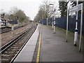
3
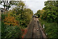
Looking Towards New Beckenham
A track-cleaning train is heading towards Beckenham Junction.
Image: © Peter Trimming
Taken: 20 Oct 2020
0.05 miles
4
New Beckenham 1st railway station (site)
Opened in 1864 by the Mid Kent Railway on the line from Lewisham to Elmers End, this station only lasted until 1866. It was situated just beyond the junction, before the bridge. When the junction to the left was created (to Beckenham Junction), the station was eventually moved north to its present position.
Image: © Nigel Thompson
Taken: 4 Apr 2013
0.05 miles
6
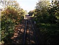
Railway to New Beckenham
As seen from Image
This section of the line leads from Clock House to New Beckenham, whose station just can be seen in the background.
Image: © David Anstiss
Taken: 16 Oct 2011
0.06 miles
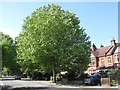
7
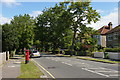
Kings Hall Road
Oaks were coming into leaf.
Image: © Stephen Richards
Taken: 12 May 2012
0.06 miles
8
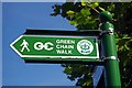
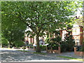
Green Chain
The waymarker for the Green Chain http://www.ldwa.org.uk/ldp/members/show_path.php?path_name=Green+Chain+Walk and Capital Ring http://www.ldwa.org.uk/ldp/members/show_path.php?path_name=Capital+Ring long distance paths.
Image: © Glyn Baker
Taken: 28 Aug 2013
0.07 miles
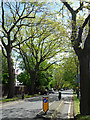
9
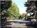
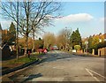
Mini roundabout on King's Hall Road
King's Hall Road leads from Kent House Road towards Lennard Road.
Bridge Road leads right towards Copers Cope Road.
Image: © David Anstiss
Taken: 16 Oct 2011
0.07 miles