
IMAGES TAKEN NEAR TO
Fashoda Road, BROMLEY, BR2 9RE
Introduction
This page details the photographs taken nearby to Fashoda Road, BR2 9RE by members of the Geograph project.
The Geograph project started in 2005 with the aim of publishing, organising and preserving representative images for every square kilometre of Great Britain, Ireland and the Isle of Man.

There are currently over 7.5m images from over14,400 individuals and you can help contribute to the project by visiting https://www.geograph.org.uk
Image Map
Images are licensed for reuse under creativecommons.org/licenses/by-sa/2.0
Notes
- Clicking on the map will re-center to the selected point.
- The higher the marker number, the further away the image location is from the centre of the postcode.
Image Listing (41 Images Found)
Images are licensed for reuse under creativecommons.org/licenses/by-sa/2.0
Image
Details
Distance
1
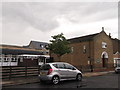
St. Swithens Roman Catholic Church
On Fashoda Road.
The connected church is on the left.
Image: © David Anstiss
Taken: 28 Aug 2011
0.04 miles
2
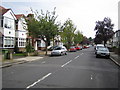
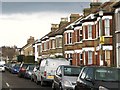
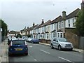
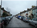
Bromley Common: Fashoda Road
The curious name of this road originates from a place called Fashoda on the White Nile in Sudan which lay approximately on the intersection of the British (Cairo to the Cape of Good Hope) and French (Senegal to Sudan) desired lines of influence in Africa during the 19th century. In 1898 small military forces from both countries met there, creating the so-called Fashoda Incident, and widespread popular outrage at the other side's imperial expansionism was so great in the following months that the two countries nearly went to war over their rival claims to the place. The road and its houses were probably built shortly afterwards in celebration of a perceived British victory.
Image: © Nigel Cox
Taken: 12 Sep 2006
0.05 miles
3
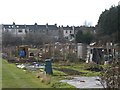
Allotments, Baths Road, BR2 (3)
The east branch of the River Ravensbourne runs left to right at the far side of the allotments - see the satellite image http://wtp2.appspot.com/wheresthepath.htm?lat=51.39653816893914&lon=0.03735244274139404&gz=18&oz=10>=1.
Image: © Mike Quinn
Taken: 12 Mar 2010
0.08 miles
4
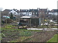
Allotments, Baths Road, BR2
The east branch of the River Ravensbourne runs left to right at the far side of the allotments - see the satellite image http://wtp2.appspot.com/wheresthepath.htm?lat=51.39653816893914&lon=0.03735244274139404&gz=18&oz=10>=1.
Image: © Mike Quinn
Taken: 12 Mar 2010
0.08 miles
6
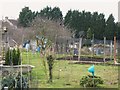
Allotments, Baths Road, BR2 (2)
The east branch of the River Ravensbourne runs through the allotments - see the satellite image http://wtp2.appspot.com/wheresthepath.htm?lat=51.39653816893914&lon=0.03735244274139404&gz=18&oz=10>=1.
Image: © Mike Quinn
Taken: 12 Mar 2010
0.09 miles
7
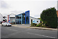
Jubilee Centre
The main meeting place for Jubilee Church in Bromley, which is part of the Pioneer grouping of churches.
Image: © Bill Boaden
Taken: 10 Oct 2015
0.11 miles
10
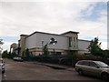
Virgin Active Health Club, Bromley
On Baths Road.
Used to be a former council baths.
Image: © David Anstiss
Taken: 28 Aug 2011
0.14 miles