IMAGES TAKEN NEAR TO
Cameron Road, BROMLEY, BR2 9BG
Introduction
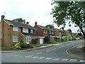
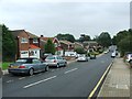
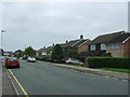
This page details the photographs taken nearby to Cameron Road, BR2 9BG by members of the Geograph project.
The Geograph project started in 2005 with the aim of publishing, organising and preserving representative images for every square kilometre of Great Britain, Ireland and the Isle of Man.

There are currently over 7.5m images from over14,400 individuals and you can help contribute to the project by visiting https://www.geograph.org.uk
Image Map
Images are licensed for reuse under creativecommons.org/licenses/by-sa/2.0
Notes
- Clicking on the map will re-center to the selected point.
- The higher the marker number, the further away the image location is from the centre of the postcode.
Image Listing (37 Images Found)
Images are licensed for reuse under creativecommons.org/licenses/by-sa/2.0
Image
Details
Distance
4
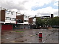
Fairacres Local Shops
This small row of shops (and matching row across the pedestrian walkway),
is near the Fairacres housing estate (in the background).
Image: © David Anstiss
Taken: 28 Aug 2011
0.06 miles
5
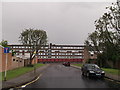
Barnhill Avenue to Fairacres
This road leads to a square housing block of Fairacres.
Image: © David Anstiss
Taken: 28 Aug 2011
0.06 miles