
IMAGES TAKEN NEAR TO
Ash Row, BROMLEY, BR2 8DZ
Introduction
This page details the photographs taken nearby to Ash Row, BR2 8DZ by members of the Geograph project.
The Geograph project started in 2005 with the aim of publishing, organising and preserving representative images for every square kilometre of Great Britain, Ireland and the Isle of Man.

There are currently over 7.5m images from over14,400 individuals and you can help contribute to the project by visiting https://www.geograph.org.uk
Image Map
Images are licensed for reuse under creativecommons.org/licenses/by-sa/2.0
Notes
- Clicking on the map will re-center to the selected point.
- The higher the marker number, the further away the image location is from the centre of the postcode.
Image Listing (19 Images Found)
Images are licensed for reuse under creativecommons.org/licenses/by-sa/2.0
Image
Details
Distance
1
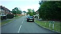
Junction of Whitebeam Avenue and Larch Way
Image: © Clint Mann
Taken: 31 Jul 2015
0.10 miles
2
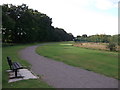
Footpath to Bromley Common Recreational Ground
A path leads from Holbrook Way, past Parkfield Recreational Ground, towards
another footpath between Whitebeam Avenue and Prince's Plain.
It leads around Bromley Public golf course (on the right).
Image: © David Anstiss
Taken: 28 Aug 2011
0.14 miles
3
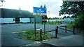
Entrance to Youth Centre off Whitebeam Avenue
Image: © Clint Mann
Taken: 31 Jul 2015
0.14 miles
4
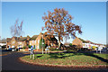
Roundabout, Faringdon Avenue
Junction with Birch Row. This is on a roadside section along the London Loop ldp.
Image: © Des Blenkinsopp
Taken: 2 Dec 2019
0.14 miles
5
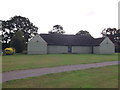
Parkfield Recreational Ground Pavilion
Unused sports pavilion near Whitebeam Avenue.
Image: © David Anstiss
Taken: 28 Aug 2011
0.16 miles
6
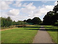
Footpath to Holbrook Way
A path leads from another footpath between Whitebeam Avenue and Prince's Plain.
It leads around Bromley Public golf course (on the left) towards Parkfield Recreational Ground.
Image: © David Anstiss
Taken: 28 Aug 2011
0.18 miles
7

Bromley Public Golf Course
Pay and play golf Course.
Seen from Parkfield Recreational Ground.
Image: © David Anstiss
Taken: 28 Aug 2011
0.18 miles
10
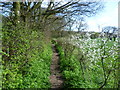
Springtime along the path to Crofton Heath
This footpath leads from Parkfield Recreation Ground and the end of Whitebeam Avenue past the back gardens of houses on the left before entering the extensive block of woodlands between Orpington, Locksbottom and Southborough, which include Crofton Heath and Sparrow Wood. The trees at Crofton Heath can just be seen on the right.
Image: © Marathon
Taken: 9 Apr 2014
0.21 miles