IMAGES TAKEN NEAR TO
Montcalm Close, BROMLEY, BR2 7LZ
Introduction
This page details the photographs taken nearby to Montcalm Close, BR2 7LZ by members of the Geograph project.
The Geograph project started in 2005 with the aim of publishing, organising and preserving representative images for every square kilometre of Great Britain, Ireland and the Isle of Man.

There are currently over 7.5m images from over14,400 individuals and you can help contribute to the project by visiting https://www.geograph.org.uk
Image Map
Images are licensed for reuse under creativecommons.org/licenses/by-sa/2.0
Notes
- Clicking on the map will re-center to the selected point.
- The higher the marker number, the further away the image location is from the centre of the postcode.
Image Listing (43 Images Found)
Images are licensed for reuse under creativecommons.org/licenses/by-sa/2.0
Image
Details
Distance
5
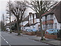
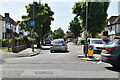
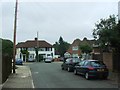
Bourne Vale, BR2 (2)
The 1930s OS map http://openspace.nearby.org.uk/wheresthepath.htm?lat=51.38094141219077&lon=0.014506679202601471&gz=14&oz=9>=5 shows that the River Ravensbourne - Hayes Branch rises just north of Pickhurst Lane and flows to the east of Bourne Vale and under the western ends of Northbourne and Southbourne. Nothing of the stream is now visible above ground until it reaches Bromley Football Club - see Image
Image: © Mike Quinn
Taken: 11 Jan 2011
0.09 miles
6
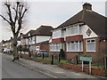
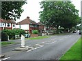
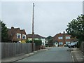
Bourne Vale, BR2
The 1930s OS map http://openspace.nearby.org.uk/wheresthepath.htm?lat=51.38094141219077&lon=0.014506679202601471&gz=14&oz=9>=5 shows that the River Ravensbourne - Hayes Branch rises just north of Pickhurst Lane and flows to the east of Bourne Vale and under the western ends of Northbourne and Southbourne. Nothing of the stream is now visible above ground until it reaches Bromley Football Club - see Image
Image: © Mike Quinn
Taken: 11 Jan 2011
0.09 miles