IMAGES TAKEN NEAR TO
Sackville Avenue, BROMLEY, BR2 7JS
Introduction
This page details the photographs taken nearby to Sackville Avenue, BR2 7JS by members of the Geograph project.
The Geograph project started in 2005 with the aim of publishing, organising and preserving representative images for every square kilometre of Great Britain, Ireland and the Isle of Man.

There are currently over 7.5m images from over14,400 individuals and you can help contribute to the project by visiting https://www.geograph.org.uk
Image Map
Images are licensed for reuse under creativecommons.org/licenses/by-sa/2.0
Notes
- Clicking on the map will re-center to the selected point.
- The higher the marker number, the further away the image location is from the centre of the postcode.
Image Listing (43 Images Found)
Images are licensed for reuse under creativecommons.org/licenses/by-sa/2.0
Image
Details
Distance
1
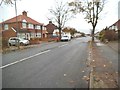
Boure Vale Scene
The view in Hayes, Bromley.
Image: © Gordon Griffiths
Taken: 14 Nov 2016
0.05 miles
2
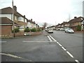
Trevor Close View
The view from Bourne Vale in Hayes, Bromley.
Image: © Gordon Griffiths
Taken: 14 Nov 2016
0.11 miles
3
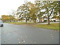
The Green
The view from Pittsmead Avenue in Hayes, Bromley.
Image: © Gordon Griffiths
Taken: 14 Nov 2016
0.13 miles
4
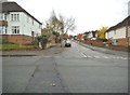
Cherry Walk
The view from Pittsmead Avenue in Hayes, Bromley.
Image: © Gordon Griffiths
Taken: 14 Nov 2016
0.14 miles
5
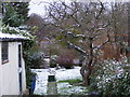
Bromley Snow
The view of the first snow of 2016 in a Hayes garden.
Image: © Gordon Griffiths
Taken: 17 Jan 2016
0.14 miles
6
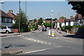
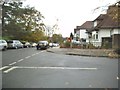
Hayes, Kent: Pickhurst Lane
Looking west from its junction with Station Approach. Pickhurst Lane is part of the B251, linking Hayes with Beckenham.
Image: © Dr Neil Clifton
Taken: 21 Jun 2010
0.15 miles
7
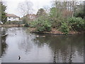
Pond, Pickhurst Lane Recreation Gardens (2)
The water from this pond must flow northwards into the River Ravensbourne - Hayes Branch - see Image
Image: © Mike Quinn
Taken: 11 Jan 2011
0.16 miles
8
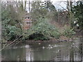
Pond, Pickhurst Lane Recreation Gardens
The water from this pond must flow northwards into the River Ravensbourne - Hayes Branch. The 1930s OS map http://openspace.nearby.org.uk/wheresthepath.htm?lat=51.38094141219077&lon=0.014506679202601471&gz=14&oz=9>=5 shows that the River Ravensbourne - Hayes Branch rises just north of Pickhurst Lane and flows to the east of Bourne Vale and under the western ends of Northbourne and Southbourne. Nothing of the stream is now visible above ground until it reaches Bromley Football Club - see Image
Image: © Mike Quinn
Taken: 11 Jan 2011
0.16 miles
9
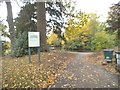
Husseywell Park
The view off Pickhurst Lane in Hayes, Bromley.
Image: © Gordon Griffiths
Taken: 14 Nov 2016
0.16 miles
10
Cherry Walk View
The view towards Stanhope Avenue in Hayes, Bromley.
Image: © Gordon Griffiths
Taken: 14 Nov 2016
0.16 miles