
IMAGES TAKEN NEAR TO
Stanhope Avenue, BROMLEY, BR2 7JR
Introduction
This page details the photographs taken nearby to Stanhope Avenue, BR2 7JR by members of the Geograph project.
The Geograph project started in 2005 with the aim of publishing, organising and preserving representative images for every square kilometre of Great Britain, Ireland and the Isle of Man.

There are currently over 7.5m images from over14,400 individuals and you can help contribute to the project by visiting https://www.geograph.org.uk
Image Map
Images are licensed for reuse under creativecommons.org/licenses/by-sa/2.0
Notes
- Clicking on the map will re-center to the selected point.
- The higher the marker number, the further away the image location is from the centre of the postcode.
Image Listing (131 Images Found)
Images are licensed for reuse under creativecommons.org/licenses/by-sa/2.0
Image
Details
Distance
2
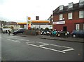
Hayes Garage
The view in Pickhurst Lane, Hayes.
Image: © Gordon Griffiths
Taken: 14 Nov 2016
0.05 miles
3
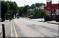
Hayes, Kent: Pickhurst Lane
Looking east, this is part of the B251, which terminates not far away at a T-junction with the B265.
Image: © Dr Neil Clifton
Taken: 21 Jun 2010
0.07 miles
4

Yoga Feeling
Yoga Studio in Hayes, Kent
Image: © Neil Carmichael
Taken: 20 Nov 2021
0.08 miles
5
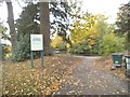
Husseywell Park
The view off Pickhurst Lane in Hayes, Bromley.
Image: © Gordon Griffiths
Taken: 14 Nov 2016
0.08 miles
6
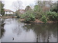
Pond, Pickhurst Lane Recreation Gardens (2)
The water from this pond must flow northwards into the River Ravensbourne - Hayes Branch - see Image
Image: © Mike Quinn
Taken: 11 Jan 2011
0.08 miles
8
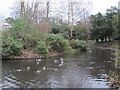
Pond, Pickhurst Lane Recreation Gardens (3)
The water from this pond must flow northwards into the River Ravensbourne - Hayes Branch - see Image
Image: © Mike Quinn
Taken: 11 Jan 2011
0.09 miles
9
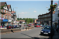
Hayes, Kent: Station Approach
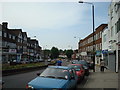
This i a spacious dual-carriageway with shops on both sides, which grew up mainly in the 1930s. The single-deck bus seen approaching is on Route 314, from Eltham Station and destined for New Addington.
Image: © Dr Neil Clifton
Taken: 21 Jun 2010
0.09 miles
10
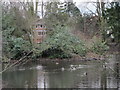
Pond, Pickhurst Lane Recreation Gardens
The water from this pond must flow northwards into the River Ravensbourne - Hayes Branch. The 1930s OS map http://openspace.nearby.org.uk/wheresthepath.htm?lat=51.38094141219077&lon=0.014506679202601471&gz=14&oz=9>=5 shows that the River Ravensbourne - Hayes Branch rises just north of Pickhurst Lane and flows to the east of Bourne Vale and under the western ends of Northbourne and Southbourne. Nothing of the stream is now visible above ground until it reaches Bromley Football Club - see Image
Image: © Mike Quinn
Taken: 11 Jan 2011
0.09 miles