IMAGES TAKEN NEAR TO
Blackness Lane, KESTON, BR2 6HS
Introduction
This page details the photographs taken nearby to Blackness Lane, BR2 6HS by members of the Geograph project.
The Geograph project started in 2005 with the aim of publishing, organising and preserving representative images for every square kilometre of Great Britain, Ireland and the Isle of Man.

There are currently over 7.5m images from over14,400 individuals and you can help contribute to the project by visiting https://www.geograph.org.uk
Image Map
Images are licensed for reuse under creativecommons.org/licenses/by-sa/2.0
Notes
- Clicking on the map will re-center to the selected point.
- The higher the marker number, the further away the image location is from the centre of the postcode.
Image Listing (40 Images Found)
Images are licensed for reuse under creativecommons.org/licenses/by-sa/2.0
Image
Details
Distance
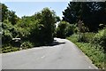
2
Jackass Lane by the junction with Blackness Lane
Image: © David Howard
Taken: 27 Jan 2013
0.03 miles
3
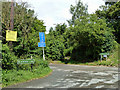
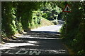
Junction of Jackass and Blackness Lanes and Church Road
There are some unusual road names in this area. Jackass Lane continues Church Road to the left. Its name board was once beside that for Church Road, but it is now missing. On the other hand, the yellow sign giving advance warning of road closure should be missing, as it is over two months out of date.
Image: © Robin Webster
Taken: 18 Jun 2011
0.03 miles
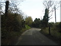
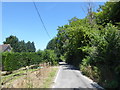
4
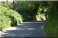
Blackness Lane
Blackness Lane runs downhill from Leaves Green Road at the north end of Biggin Hill. It is very narrow all the way along as it was clearly just a country lane before housing was added on both sides except at this northern end near the junction with Church Road and Jackass Lane. The bridleway on the left leads via Furze Bottom to either Layhams Farm or Higham's Hill.
Image: © Marathon
Taken: 5 Jul 2017
0.03 miles
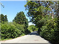
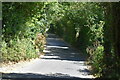
6
Blackness Lane
Blackness Lane runs downhill from Leaves Green Road at the north end of Biggin Hill. It is very narrow all the way along as it was clearly just a country lane before housing was added on both sides.
Image: © Marathon
Taken: 5 Jul 2017
0.05 miles
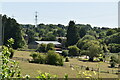
10
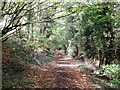
Bridleway to Furze Bottom
This wide track leads from Blackness Lane, through Keston Fruit Farm towards Furze Bottom (wood) and Sheepbarn Lane near New Addington.
Image: © David Anstiss
Taken: 9 Oct 2011
0.10 miles