IMAGES TAKEN NEAR TO
Romanhurst Gardens, BROMLEY, BR2 0PA
Introduction
This page details the photographs taken nearby to Romanhurst Gardens, BR2 0PA by members of the Geograph project.
The Geograph project started in 2005 with the aim of publishing, organising and preserving representative images for every square kilometre of Great Britain, Ireland and the Isle of Man.

There are currently over 7.5m images from over14,400 individuals and you can help contribute to the project by visiting https://www.geograph.org.uk
Image Map
Images are licensed for reuse under creativecommons.org/licenses/by-sa/2.0
Notes
- Clicking on the map will re-center to the selected point.
- The higher the marker number, the further away the image location is from the centre of the postcode.
Image Listing (23 Images Found)
Images are licensed for reuse under creativecommons.org/licenses/by-sa/2.0
Image
Details
Distance
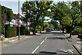
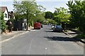
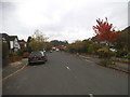
6
Kingswood Avenue at the junction of Hayes Lane
Taken from Bromley looking to Beckenham past the junction.
Image: © David Howard
Taken: 18 Oct 2015
0.07 miles
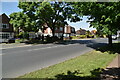
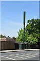
9
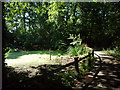
Footpath by ponds from South Hill Road BR2
This path, which passes three small ponds, joins South Hill Road with Kingswood Avenue.
Image: © Philip Talmage
Taken: 31 Aug 2005
0.11 miles
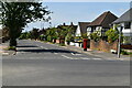
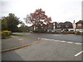
10
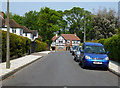
Bromley: Romanhurst Avenue
Cul-de-sac off Tootswood Road
Image: © Dr Neil Clifton
Taken: 24 May 2012
0.12 miles