IMAGES TAKEN NEAR TO
Haddington Road, BROMLEY, BR1 5RQ
Introduction
This page details the photographs taken nearby to Haddington Road, BR1 5RQ by members of the Geograph project.
The Geograph project started in 2005 with the aim of publishing, organising and preserving representative images for every square kilometre of Great Britain, Ireland and the Isle of Man.

There are currently over 7.5m images from over14,400 individuals and you can help contribute to the project by visiting https://www.geograph.org.uk
Image Map
Images are licensed for reuse under creativecommons.org/licenses/by-sa/2.0
Notes
- Clicking on the map will re-center to the selected point.
- The higher the marker number, the further away the image location is from the centre of the postcode.
Image Listing (46 Images Found)
Images are licensed for reuse under creativecommons.org/licenses/by-sa/2.0
Image
Details
Distance
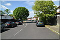
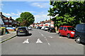
3
The Green Chain Walk crosses Downderry Road
The long distance path leads along the Downham Woodlands Walk, through Downham towards Grove Park.
Image: © David Anstiss
Taken: 18 Sep 2011
0.07 miles
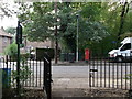
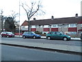
4
Entrance to Forster Memorial Park
The eastern way in from Whitefoot Lane. Image and Image give information about the origin of the park https://www.lewisham.gov.uk/inmyarea/openspaces/parks/forster-memorial-park/Pages/default.aspx .
Image: © Derek Harper
Taken: 9 May 2013
0.08 miles
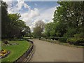
5
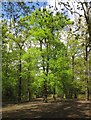
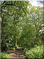
Trees, Forster Memorial Park
Fresh spring leaves on trees near the path shown in Image
Image: © Derek Harper
Taken: 9 May 2013
0.08 miles
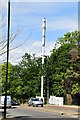
8
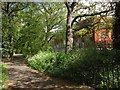
Downham Woodland Walk
Followed by the Green Chain Walk and the Capital Ring, the walk continues east of Downderry Road. The new building on the right is at what is mapped as an annexe for both Bonus Pastor Catholic College and Catford County School.
Image: © Derek Harper
Taken: 9 May 2013
0.09 miles
9
Downham Woodland Walk
The dog waste bin can be seen on the left of Image
Image: © Derek Harper
Taken: 9 May 2013
0.09 miles
10
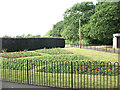
Forster Park, Catford (3)
A flower bed at the south-east entrance to the park from Whitefoot Lane.
Image: © Stephen Craven
Taken: 29 Jun 2010
0.09 miles