IMAGES TAKEN NEAR TO
Oakridge Road, BROMLEY, BR1 5QW
Introduction
This page details the photographs taken nearby to Oakridge Road, BR1 5QW by members of the Geograph project.
The Geograph project started in 2005 with the aim of publishing, organising and preserving representative images for every square kilometre of Great Britain, Ireland and the Isle of Man.

There are currently over 7.5m images from over14,400 individuals and you can help contribute to the project by visiting https://www.geograph.org.uk
Image Map
Images are licensed for reuse under creativecommons.org/licenses/by-sa/2.0
Notes
- Clicking on the map will re-center to the selected point.
- The higher the marker number, the further away the image location is from the centre of the postcode.
Image Listing (67 Images Found)
Images are licensed for reuse under creativecommons.org/licenses/by-sa/2.0
Image
Details
Distance
2
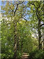
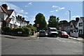
Green Chain Walk: West from Haddington Road
Image: © Dr Neil Clifton
Taken: 30 Aug 2012
0.03 miles
4
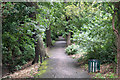
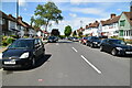
Downham Woodland Walk
Further east along Image] as it approaches an easting gridline.
Image: © Derek Harper
Taken: 9 May 2013
0.03 miles
8
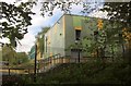
Bonus Pastor Catholic College, Downham
New buildings at the secondary school, seen from Downham Woodland Walk.
Image: © Derek Harper
Taken: 9 May 2013
0.07 miles
9
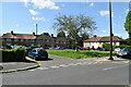
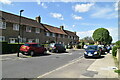
Downham: Haddington Road
Looking north, from where the Green Chain Walk crosses Haddington Road
Image: © Dr Neil Clifton
Taken: 30 Aug 2012
0.07 miles
10
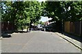
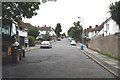
Winlaton Road
The crane may be on the site of a school but it was not investigated.
Image: © Robin Webster
Taken: 19 Nov 2011
0.08 miles