
IMAGES TAKEN NEAR TO
Churchdown, BROMLEY, BR1 5PQ
Introduction
This page details the photographs taken nearby to Churchdown, BR1 5PQ by members of the Geograph project.
The Geograph project started in 2005 with the aim of publishing, organising and preserving representative images for every square kilometre of Great Britain, Ireland and the Isle of Man.

There are currently over 7.5m images from over14,400 individuals and you can help contribute to the project by visiting https://www.geograph.org.uk
Image Map
Images are licensed for reuse under creativecommons.org/licenses/by-sa/2.0
Notes
- Clicking on the map will re-center to the selected point.
- The higher the marker number, the further away the image location is from the centre of the postcode.
Image Listing (61 Images Found)
Images are licensed for reuse under creativecommons.org/licenses/by-sa/2.0
Image
Details
Distance
1
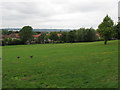
Downham Fields
The Fields are an urban park, mostly grassland, about 800m long and up to 200m wide, within the Downham inter-war housing estate. The site is on the westward facing slope of a low hill and gives views across to Crystal Palace and Sydenham (marked by the two transmitters in the distance).
Image: © Stephen Craven
Taken: 26 Aug 2010
0.07 miles
3
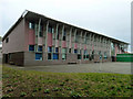
Building, New Woodlands School
A primary school (4 - eventually 14) for those with behavioural, emotional and social difficulty.
Image: © Robin Webster
Taken: 30 Oct 2011
0.11 miles
4
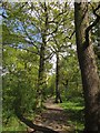
Downham Woodland Walk
Image: © Derek Harper
Taken: 9 May 2013
0.12 miles
5
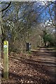
Green Chain Walk and Capital Ring
One could almost convince yourself this was a country walk and not a sliver of green in suburban Downham, see also Image
Image: © Glyn Baker
Taken: 1 Feb 2018
0.12 miles
6
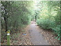
Downham Woodland Walk
This woodland walk is a long narrow strip of ancient woodland that runs for nearly a mile through the Downham Estate. This section is between Downderry Road and Moorside Road.
It is part of the Green Chain Walk (long distance walk) and it contains some magnificent old oak and ash trees.
Image: © David Anstiss
Taken: 18 Sep 2011
0.12 miles
8
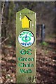
Ring & Chain
A pair of routes sharing the same footpath. The Green Chain Walk https://tfl.gov.uk/modes/walking/green-chain-walk and The Capital Ring https://tfl.gov.uk/modes/walking/capital-ring
Image: © Glyn Baker
Taken: 1 Feb 2018
0.13 miles
9
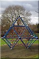
Climbing Frame on Dowmham Fields
Located beside the Image
Image: © Glyn Baker
Taken: 1 Feb 2018
0.13 miles
10
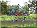
Contemporary climbing frame
Previous play equipment in Downham Fields Image appears to have been removed and replaced with nothing more than this geodesic climbing frame (plus a couple of small football goalposts).
Image: © Stephen Craven
Taken: 26 Aug 2010
0.14 miles