IMAGES TAKEN NEAR TO
Cress Mews, BROMLEY, BR1 4LU
Introduction
This page details the photographs taken nearby to Cress Mews, BR1 4LU by members of the Geograph project.
The Geograph project started in 2005 with the aim of publishing, organising and preserving representative images for every square kilometre of Great Britain, Ireland and the Isle of Man.

There are currently over 7.5m images from over14,400 individuals and you can help contribute to the project by visiting https://www.geograph.org.uk
Image Map
Images are licensed for reuse under creativecommons.org/licenses/by-sa/2.0
Notes
- Clicking on the map will re-center to the selected point.
- The higher the marker number, the further away the image location is from the centre of the postcode.
Image Listing (75 Images Found)
Images are licensed for reuse under creativecommons.org/licenses/by-sa/2.0
Image
Details
Distance
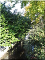
2
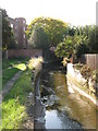
The River Ravensbourne south of Bamford Road, BR1
Image: © Mike Quinn
Taken: 8 Oct 2009
0.04 miles
3
The River Ravensbourne south of Bamford Road, BR1
Image: © Mike Quinn
Taken: 8 Oct 2009
0.04 miles
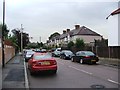
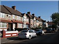
4
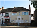
Fat Belly's
At the north end of Old Bromley Road, BR1.
Image: © Mike Quinn
Taken: 8 Oct 2009
0.05 miles
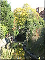
5
The River Ravensbourne by Dainford Close, BR1
Image: © Mike Quinn
Taken: 8 Oct 2009
0.05 miles
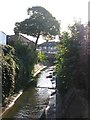
7
The River Ravensbourne north of Brangbourne Road, BR1 (2)
Image: © Mike Quinn
Taken: 8 Oct 2009
0.06 miles
8
The River Ravensbourne east of Chelford Road, BR1
Image: © Mike Quinn
Taken: 8 Oct 2009
0.07 miles
9
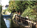
Weir on the River Ravensbourne south of Dainford Close, BR1
Image: © Mike Quinn
Taken: 8 Oct 2009
0.07 miles
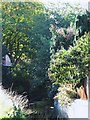
10
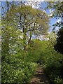
Downham Woodland Walk
The Green Chain Walk and the Capital Ring follows this delightful path through a narrow strip of woodland with housing on either side.
Image: © Derek Harper
Taken: 9 May 2013
0.07 miles