IMAGES TAKEN NEAR TO
Hillbrow Road, BROMLEY, BR1 4JL
Introduction
This page details the photographs taken nearby to Hillbrow Road, BR1 4JL by members of the Geograph project.
The Geograph project started in 2005 with the aim of publishing, organising and preserving representative images for every square kilometre of Great Britain, Ireland and the Isle of Man.

There are currently over 7.5m images from over14,400 individuals and you can help contribute to the project by visiting https://www.geograph.org.uk
Image Map
Images are licensed for reuse under creativecommons.org/licenses/by-sa/2.0
Notes
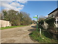
- Clicking on the map will re-center to the selected point.
- The higher the marker number, the further away the image location is from the centre of the postcode.
Image Listing (71 Images Found)
Images are licensed for reuse under creativecommons.org/licenses/by-sa/2.0
Image
Details
Distance
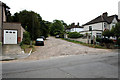
1
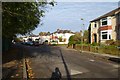
Calmont Road
Looking along Calmont Road at the junction with Hill Brow Road.
Image: © DS Pugh
Taken: 29 Nov 2014
0.05 miles
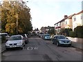
4
The view down Coniston Road
From outside the Bromley Court Hotel.
Image: © Stanley Howe
Taken: 21 Feb 2009
0.08 miles
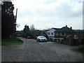
5
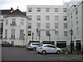
Bromley Court Hotel
A Best Western Hotel
Image: © Alex McGregor
Taken: 27 May 2011
0.08 miles
6
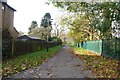
Playing fields path
Part of the Green Chain walk.
Image: © DS Pugh
Taken: 29 Nov 2014
0.08 miles
7
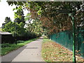
Green Chain Walk enters Ravensbourne Playing Field
The long-distance path leads from Warren Avenue along a path between a playing field and sports ground towards Ravensbourne.
Image: © David Anstiss
Taken: 18 Sep 2011
0.09 miles
8
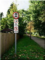
Posh Area?
Green Chain Walk, leading to Ravensbourne Station and Beckenham Place Park.
Image: © Peter Trimming
Taken: 1 Nov 2021
0.09 miles
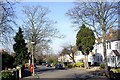
9
Elstree Hill, Green Chain Walk
So much of the Green Chain / Capital Ring route is along pavements, cycle tracks and nice municipal park pathways that this unadopted residential street seems dangerously close to off road walking..
Image: © Des Blenkinsopp
Taken: 24 Feb 2016
0.09 miles
10
Green Chain Walk: Elstree Hill
The Green Chain Walk continues eastward up the unmade Elstree Hill.
Image: © Dr Neil Clifton
Taken: 25 Aug 2012
0.09 miles