
IMAGES TAKEN NEAR TO
Apollo Avenue, BROMLEY, BR1 3TB
Introduction
This page details the photographs taken nearby to Apollo Avenue, BR1 3TB by members of the Geograph project.
The Geograph project started in 2005 with the aim of publishing, organising and preserving representative images for every square kilometre of Great Britain, Ireland and the Isle of Man.

There are currently over 7.5m images from over14,400 individuals and you can help contribute to the project by visiting https://www.geograph.org.uk
Image Map
Images are licensed for reuse under creativecommons.org/licenses/by-sa/2.0
Notes
- Clicking on the map will re-center to the selected point.
- The higher the marker number, the further away the image location is from the centre of the postcode.
Image Listing (88 Images Found)
Images are licensed for reuse under creativecommons.org/licenses/by-sa/2.0
Image
Details
Distance
1

Footbridge over the railway
Leads from Babbacombe Road to Coppergate Close.
It leads over the Bromley North to Sundridge Park railway line.
Image: © David Anstiss
Taken: 27 Nov 2010
0.03 miles
2

Railway to Sundridge Park
These lines lead from Bromley North towards Sundridge Park and onwards to London.
Image: © David Anstiss
Taken: 27 Nov 2010
0.06 miles
3
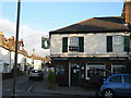
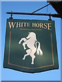
White Horse Public House, Bromley
On the junction of Palace Road (in front) and North Road (on the left).
Image: © David Anstiss
Taken: 27 Nov 2010
0.09 miles
4
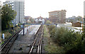
Bromley North station, 1988
View SW, to buffers: ex-SE&CR terminus of branch from Grove Park. (Cf.Image]).
Image: © Ben Brooksbank
Taken: 15 Oct 1988
0.09 miles
6
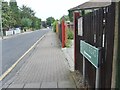
Rodway Road
The view from Sherman Road, Bromley.
Image: © Gordon Griffiths
Taken: 2 Jun 2012
0.10 miles
7
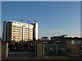
Bromley Charter Market
On Station Road, opposite Glebe Road.
In the background, is North Point, a block of flats on Sherman Road.
Image: © David Anstiss
Taken: 27 Nov 2010
0.10 miles
8

Bromley North Station
View SW, towards buffer-stops; terminus of ex-South Eastern & Chatham branch from Grove Park - still an active London suburban station. Goods facilities have long since disappeared, closed 20/5/68.
Image: © Ben Brooksbank
Taken: 2 Mar 1961
0.10 miles
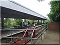
10
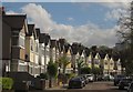
Babbacombe Road, Plaistow
Gables curve along the east side of the road. The further terrace is in Image
Image: © Derek Harper
Taken: 9 May 2013
0.11 miles