IMAGES TAKEN NEAR TO
Howard Road, BROMLEY, BR1 3QJ
Introduction
This page details the photographs taken nearby to Howard Road, BR1 3QJ by members of the Geograph project.
The Geograph project started in 2005 with the aim of publishing, organising and preserving representative images for every square kilometre of Great Britain, Ireland and the Isle of Man.

There are currently over 7.5m images from over14,400 individuals and you can help contribute to the project by visiting https://www.geograph.org.uk
Image Map
Images are licensed for reuse under creativecommons.org/licenses/by-sa/2.0
Notes
- Clicking on the map will re-center to the selected point.
- The higher the marker number, the further away the image location is from the centre of the postcode.
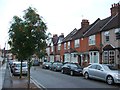
Image Listing (48 Images Found)
Images are licensed for reuse under creativecommons.org/licenses/by-sa/2.0
Image
Details
Distance
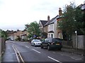
1
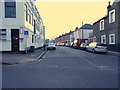
Scotts Road from College Road, Plaistow
Image: © David Howard
Taken: 23 Feb 2014
0.08 miles
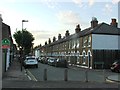
4
The Grillery
Restaurant and bar on the junction of the A2212 College Road (on the right) and Morgan Road (on the left).
Image: © David Anstiss
Taken: 27 Nov 2010
0.10 miles
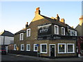
5
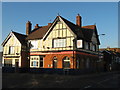
The Farwig Public House
On the junction of the A2212 College Road (on the right) and Farwig Lane (on the left).
Image: © David Anstiss
Taken: 27 Nov 2010
0.10 miles
6
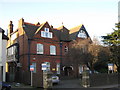
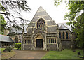
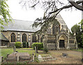
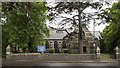
St. Mary's Church House
Rooms and Hall for hire, beside the Parish Church of St.Mary (on the right).
On College Road.
Image: © David Anstiss
Taken: 27 Nov 2010
0.11 miles