IMAGES TAKEN NEAR TO
Heighton Crescent, NEWHAVEN, BN9 0QT
Introduction
This page details the photographs taken nearby to Heighton Crescent, BN9 0QT by members of the Geograph project.
The Geograph project started in 2005 with the aim of publishing, organising and preserving representative images for every square kilometre of Great Britain, Ireland and the Isle of Man.

There are currently over 7.5m images from over14,400 individuals and you can help contribute to the project by visiting https://www.geograph.org.uk
Image Map
Images are licensed for reuse under creativecommons.org/licenses/by-sa/2.0
Notes
- Clicking on the map will re-center to the selected point.
- The higher the marker number, the further away the image location is from the centre of the postcode.
Image Listing (50 Images Found)
Images are licensed for reuse under creativecommons.org/licenses/by-sa/2.0
Image
Details
Distance
1
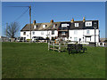
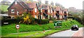
Southview Terrace
Taken from the small village green in front of the terrace. The chair is dedicated to HMS Forward 1940-45 a secret naval base built underneath the village of South Heighton.
Image: © Simon Carey
Taken: 21 Feb 2009
0.08 miles
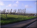
2
Pit Brook
The name of the field according to the 1842 South Heighton tithe map that has been expanded to include Image to the west. Heighton Quarry can be seen in the distance.
Image: © Simon Carey
Taken: 22 Oct 2011
0.09 miles
3
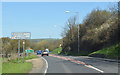
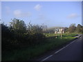
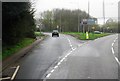
A26 out of Newhaven
As Newhaven is a port, foreigners are reminded to drive on the left.
Image: © J.Hannan-Briggs
Taken: 12 Apr 2015
0.09 miles
4
New Road, South Heighton
Overlooking the South Downs
Image: © David Howard
Taken: 12 Sep 2011
0.11 miles
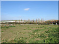
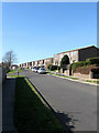
6
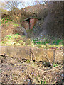
Western entrance to HMS Forward, World War Two Naval HQ, South Heighton
During the Second World War what was then private land was requisitioned by the government to provide a secret underground Naval communications HQ. Built underneath South Heighton it fell into disuse after the war.Pictures from inside can be seen at this http://www.subbrit.org.uk/sb-sites/sites/f/hms_forward/index.shtml Now recognised by English Heritage as a site of national importance it is hoped to restore the tunnels to a condition allowing public access. More information can be found at this http://www.secret-tunnels.co.uk/ The entrance is on New Road, the A26, whilst the houses above belong to Heighton Crescent.
Image: © Simon Carey
Taken: 17 Feb 2006
0.12 miles
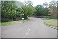
9
Iveagh Crescent
A continuation of Denton Rise that heads back towards the B2109. The estate was built in the 1970s.
Image: © Simon Carey
Taken: 21 Feb 2009
0.12 miles