
IMAGES TAKEN NEAR TO
Laughton, LEWES, BN8 6BX
Introduction
This page details the photographs taken nearby to BN8 6BX by members of the Geograph project.
The Geograph project started in 2005 with the aim of publishing, organising and preserving representative images for every square kilometre of Great Britain, Ireland and the Isle of Man.

There are currently over 7.5m images from over14,400 individuals and you can help contribute to the project by visiting https://www.geograph.org.uk
Image Map
Images are licensed for reuse under creativecommons.org/licenses/by-sa/2.0
Notes
- Clicking on the map will re-center to the selected point.
- The higher the marker number, the further away the image location is from the centre of the postcode.
Image Listing (10 Images Found)
Images are licensed for reuse under creativecommons.org/licenses/by-sa/2.0
Image
Details
Distance

2
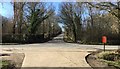
Common Lane
Looking ahead along Common Lane.
Image: © Chris Thomas-Atkin
Taken: 25 Feb 2018
0.20 miles

5
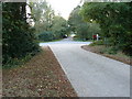
Path and road junction at Laughton Common
Common Lane is the road facing the camera.
Image: © Dave Spicer
Taken: 16 Oct 2011
0.21 miles
6
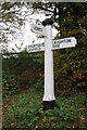
Old Direction Sign - Signpost by Shortgate Lane, Laughton Parish
Black iron cap finial - 3 arms; East Sussex wood by the UC road, in parish of Laughton (Wealden District), junction of Shortgate Lane with Common Lane, on verge opposite junction.
Surveyed
Milestone Society National ID: SX_TQ4914.
Image: © Milestone Society
Taken: Unknown
0.21 miles
7
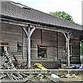
Outbuilding near Bell Farm
This is an unusual structure - slightly more interesting than your average outbuilding.
Image: © Ian Hawfinch
Taken: 15 Jun 2021
0.21 miles
8
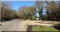
Lane Junction
The junction of several Lanes near to Laughton.
Image: © Chris Thomas-Atkin
Taken: 25 Feb 2018
0.21 miles
9

Small bridge on Shortgate Lane
In the dappled light under the trees, the slight narrowing of the lane on the left is easily missed.
Image: © Robin Webster
Taken: 16 Jun 2012
0.22 miles
10
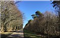
Walls?s Hawth
Pine trees had been planted at regular intervals along the edge of Walls’s Hawth.
Image: © Chris Thomas-Atkin
Taken: 25 Feb 2018
0.25 miles