IMAGES TAKEN NEAR TO
Fletching Common, LEWES, BN8 4JL
Introduction
This page details the photographs taken nearby to Fletching Common, BN8 4JL by members of the Geograph project.
The Geograph project started in 2005 with the aim of publishing, organising and preserving representative images for every square kilometre of Great Britain, Ireland and the Isle of Man.

There are currently over 7.5m images from over14,400 individuals and you can help contribute to the project by visiting https://www.geograph.org.uk
Image Map
Images are licensed for reuse under creativecommons.org/licenses/by-sa/2.0
Notes
- Clicking on the map will re-center to the selected point.
- The higher the marker number, the further away the image location is from the centre of the postcode.
Image Listing (27 Images Found)
Images are licensed for reuse under creativecommons.org/licenses/by-sa/2.0
Image
Details
Distance

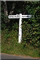
2
Sussex Ouse Valley Way signpost, Mill Lane
Image: © N Chadwick
Taken: 15 May 2010
0.05 miles
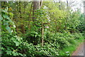
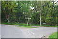
3
Roadside waymarker for the Sussex Ouse Valley Way
The path emerges from Rotherfield Wood to the left onto Mill Lane and within a few yards turns left down Newick Hill.
Image: © Dave Spicer
Taken: 18 Sep 2011
0.06 miles
4
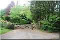
Forest Lodge, Mill Lane
Entrance to the Forestry Commission Lodge
Image: © N Chadwick
Taken: 15 May 2010
0.08 miles
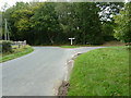
5
Old Direction Sign - Signpost by Mill Lane, Fletching Parish
Black iron cap finial - 3 arms; East Sussex wood by the UC road, in parish of Fletching (Wealden District), T-junction of Mill Lane with Newick Hill (By Fletching Common), on verge.
Surveyed
Milestone Society National ID: SX_TQ4122
Image: © Milestone Society
Taken: Unknown
0.08 miles
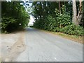
6
The junction of Newick Hill and Mill Lane
Image: © N Chadwick
Taken: 15 May 2010
0.08 miles
7
Junction between Mill Lane and Newick Hill
Image: © Dave Spicer
Taken: 18 Sep 2011
0.08 miles
8
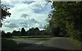
Road Junction beside Rotherfield Wood
The junction of the roads from Fletching and Newick heading towards the A275. Rotherfield Wood is on the right.
Image: © Chris Thomas-Atkin
Taken: 8 Oct 2017
0.08 miles
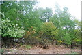
9
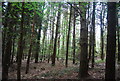
Rotherfield Wood
Forestry Commission Woodland.
Image: © N Chadwick
Taken: 15 May 2010
0.09 miles