IMAGES TAKEN NEAR TO
Wellgreen Lane, LEWES, BN7 3NR
Introduction
This page details the photographs taken nearby to Wellgreen Lane, BN7 3NR by members of the Geograph project.
The Geograph project started in 2005 with the aim of publishing, organising and preserving representative images for every square kilometre of Great Britain, Ireland and the Isle of Man.

There are currently over 7.5m images from over14,400 individuals and you can help contribute to the project by visiting https://www.geograph.org.uk
Image Map
Images are licensed for reuse under creativecommons.org/licenses/by-sa/2.0
Notes
- Clicking on the map will re-center to the selected point.
- The higher the marker number, the further away the image location is from the centre of the postcode.
Image Listing (61 Images Found)
Images are licensed for reuse under creativecommons.org/licenses/by-sa/2.0
Image
Details
Distance
2
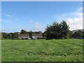
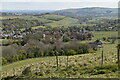
Mill Laine (3)
The name of the field according to Kingston's 1843 tithe map. Originally one of the three large open fields that surrounded Kingston from Saxon times up to enclosure in 1834. The large open fields were divided into furlongs which also had their own individual names, one of which Snednore, has survived as the name of the cul de sac whose houses are visible in the picture. This section of the old field is now used as a caravan site. See also Image, Image, Image and Image
Image: © Simon Carey
Taken: 12 Aug 2012
0.03 miles
5
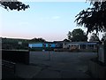
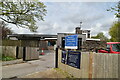
Kingston and Iford Primary School
Opened in 1965 to replace a much smaller building in Iford and located in Kingston due to its expansion after the Second World War. Viewed from an entrance on Wellgreen Lane.
Image: © Simon Carey
Taken: 10 Aug 2012
0.04 miles
6
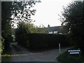
The Holdings
A small cul de sac off Wellgreen Lane built in the immediate aftermath of World War One to provide homes for returning soldiers.
Image: © Simon Carey
Taken: 12 Aug 2012
0.05 miles
7
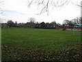
Iford & Kingston Primary School
Taken from the footpath that skirts the rear of the grounds of the school.
Image: © Simon Carey
Taken: 8 Feb 2009
0.05 miles
8
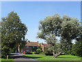
Snednore
Small cul de sac off Wellgreen Lane built in the immediate aftermath of the Second World War. The unusual name derives from that of an old furlong once found in Mill Laine.
Image: © Simon Carey
Taken: 26 Jul 2012
0.05 miles
9
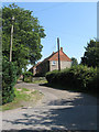
Gows Croft
Small cul de sac off Wellgreen Lane built not long after the Second World War.
Image: © Simon Carey
Taken: 26 Jul 2012
0.08 miles