
IMAGES TAKEN NEAR TO
Spences Field, LEWES, BN7 2HH
Introduction
This page details the photographs taken nearby to Spences Field, BN7 2HH by members of the Geograph project.
The Geograph project started in 2005 with the aim of publishing, organising and preserving representative images for every square kilometre of Great Britain, Ireland and the Isle of Man.

There are currently over 7.5m images from over14,400 individuals and you can help contribute to the project by visiting https://www.geograph.org.uk
Image Map
Images are licensed for reuse under creativecommons.org/licenses/by-sa/2.0
Notes
- Clicking on the map will re-center to the selected point.
- The higher the marker number, the further away the image location is from the centre of the postcode.
Image Listing (36 Images Found)
Images are licensed for reuse under creativecommons.org/licenses/by-sa/2.0
Image
Details
Distance
1

Spences Field, South Malling
A cul de sac off Spences Lane that was developed in the 1960s.
Image: © Simon Carey
Taken: 25 Aug 2025
0.02 miles
2

Spences Lane, South Malling
Originally a shorter route to Malling House and the church the old lane has been engulfed by development since the Second World War. Both its original ends, on Malling Street to the east and Church Lane to the north, are now closed, with the former redirected down Orchard Road and the later ending at Hereward Way.
Image: © Simon Carey
Taken: 25 Aug 2025
0.04 miles
3
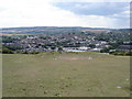
View towards Lewes from Malling Hill
The depression in the foreground looks like a dried up dew-pond
Image: © Ian Hawfinch
Taken: 2 Aug 2010
0.05 miles
5
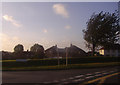
Sunset over Church Lane, South Malling
Image: © David Howard
Taken: 12 Sep 2011
0.09 miles
7
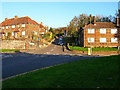
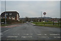
Mill Road, South Malling
Looking east from Church Lane through the junction with the A26.
Image: © Simon Carey
Taken: 13 Nov 2005
0.10 miles
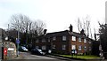
9
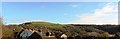
Over the rooftops to Malling Hill, Lewes
Image: © nick macneill
Taken: 9 Nov 2012
0.11 miles
10

Orchard Road, South Malling
Linking Malling Street, the A26, to Spences Lane and developed in the latter half of the 1950s.
Image: © Simon Carey
Taken: 25 Aug 2025
0.12 miles