
IMAGES TAKEN NEAR TO
Orchard Road, LEWES, BN7 2HA
Introduction
This page details the photographs taken nearby to Orchard Road, BN7 2HA by members of the Geograph project.
The Geograph project started in 2005 with the aim of publishing, organising and preserving representative images for every square kilometre of Great Britain, Ireland and the Isle of Man.

There are currently over 7.5m images from over14,400 individuals and you can help contribute to the project by visiting https://www.geograph.org.uk
Image Map
Images are licensed for reuse under creativecommons.org/licenses/by-sa/2.0
Notes
- Clicking on the map will re-center to the selected point.
- The higher the marker number, the further away the image location is from the centre of the postcode.
Image Listing (45 Images Found)
Images are licensed for reuse under creativecommons.org/licenses/by-sa/2.0
Image
Details
Distance
4
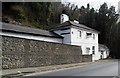
'Horsman Solicitors', Malling Street, Lewes
The area of South Malling is pronounced as in 'all' rather than 'al'. This used to be the Prince of Wales pub.
Image: © nick macneill
Taken: 14 Mar 2012
0.03 miles
5

The Spinney, South Malling
A cul de sac off Malling Street, the A26, which was built in the early 1980s.
Image: © Simon Carey
Taken: 25 Aug 2025
0.04 miles
6

Orchard Road, South Malling
Linking Malling Street, the A26, to Spences Lane and developed in the latter half of the 1950s.
Image: © Simon Carey
Taken: 25 Aug 2025
0.04 miles
7

The Nurseries, South Malling
Built around 2010 on the former site of a nursery.
Image: © Simon Carey
Taken: 25 Aug 2025
0.09 miles
8

The Chalk Yard, Malling Street, South Malling
Recently completed conversion of a former office block, called The Mallings, into residential units.
Image: © Simon Carey
Taken: 25 Aug 2025
0.10 miles
9

The Working Men's Club, Malling Street, South Malling
Originally built as a Church Hall possibly before World War One though it is not marked on the OS 1911 map but does appear on the 1930 edition. It became a club in the 1960s but it closed sometime in the 2010s since when it has been subject to a number of planning applications which appear to be divided between demolition and construction of two residential units or retain the structure and convert to three dwellings.
Image: © Simon Carey
Taken: 25 Aug 2025
0.11 miles
10
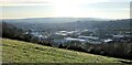
View SW over Lewes from Malling Hill
Malling Brook Industrial Estate dominates the middle distance. Lewes Castle lies to the right of centre.
Image: © Ian Hawfinch
Taken: 6 Nov 2020
0.11 miles